
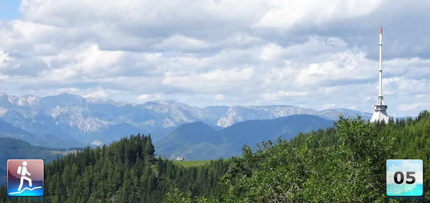
Seventeenth stage of the Nord-Süd-Weitwanderweg 05 starting from Leoben up to the Mugelschutzhaus.
 |
The North-South-Long-Distance trail (Nord-Süd-Weitwanderweg, also known as the “05”) starts in the north of Austria at Nebelstein and ends in the south of Austria at Eibiswald. The trail is ~500km long, ~18 000m in ascent and the same amount in descent. The trail was initiated by Carl Hermann and officially established on the 25th September 1970. The trail is separated into 3 parts:
It normally takes 3 weeks to complete the entire trail. |
The here presented tour is the seventeenth stage of the Nord-Süd-Weitwanderweg 05 , where the stage starts in the city of Leoben (Checkpoint) and ends at the Mugelschutzhaus (Checkpoint) next to the summit of Mugel.
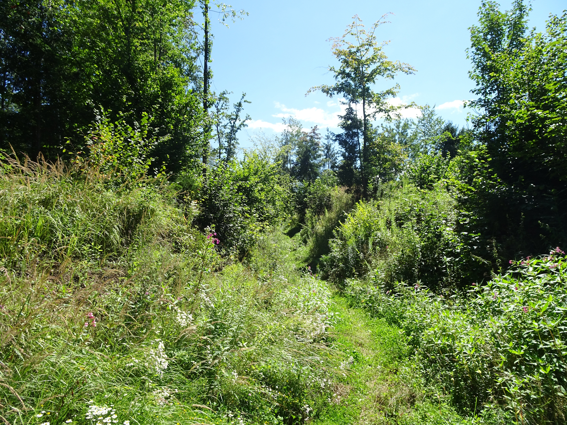
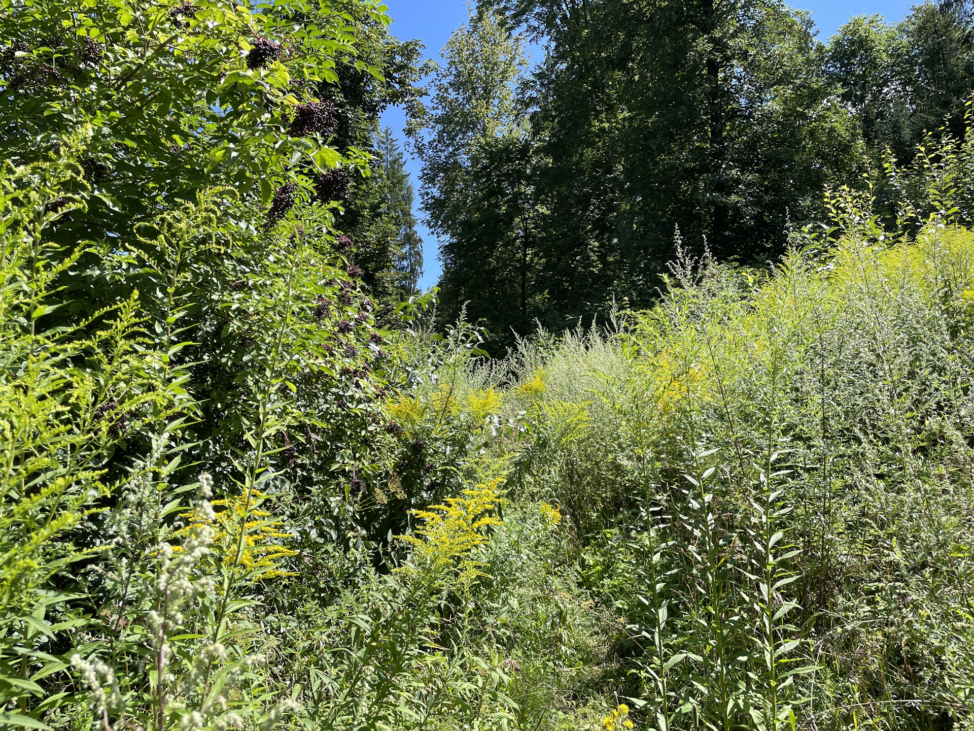
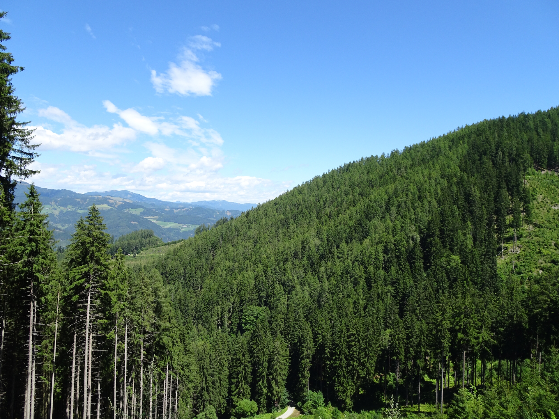
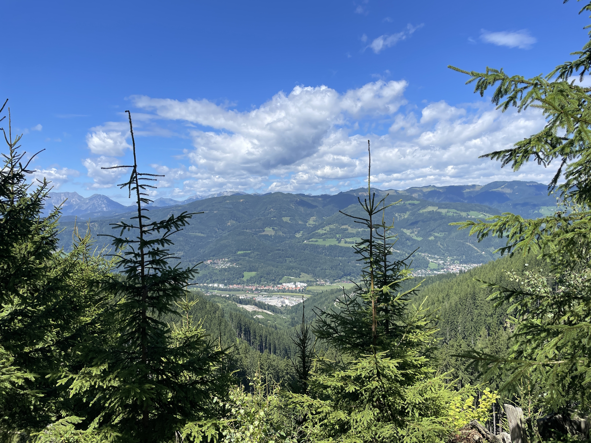
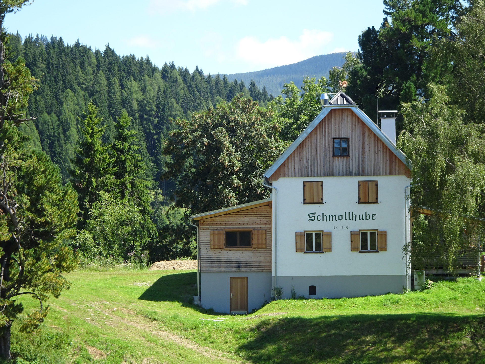
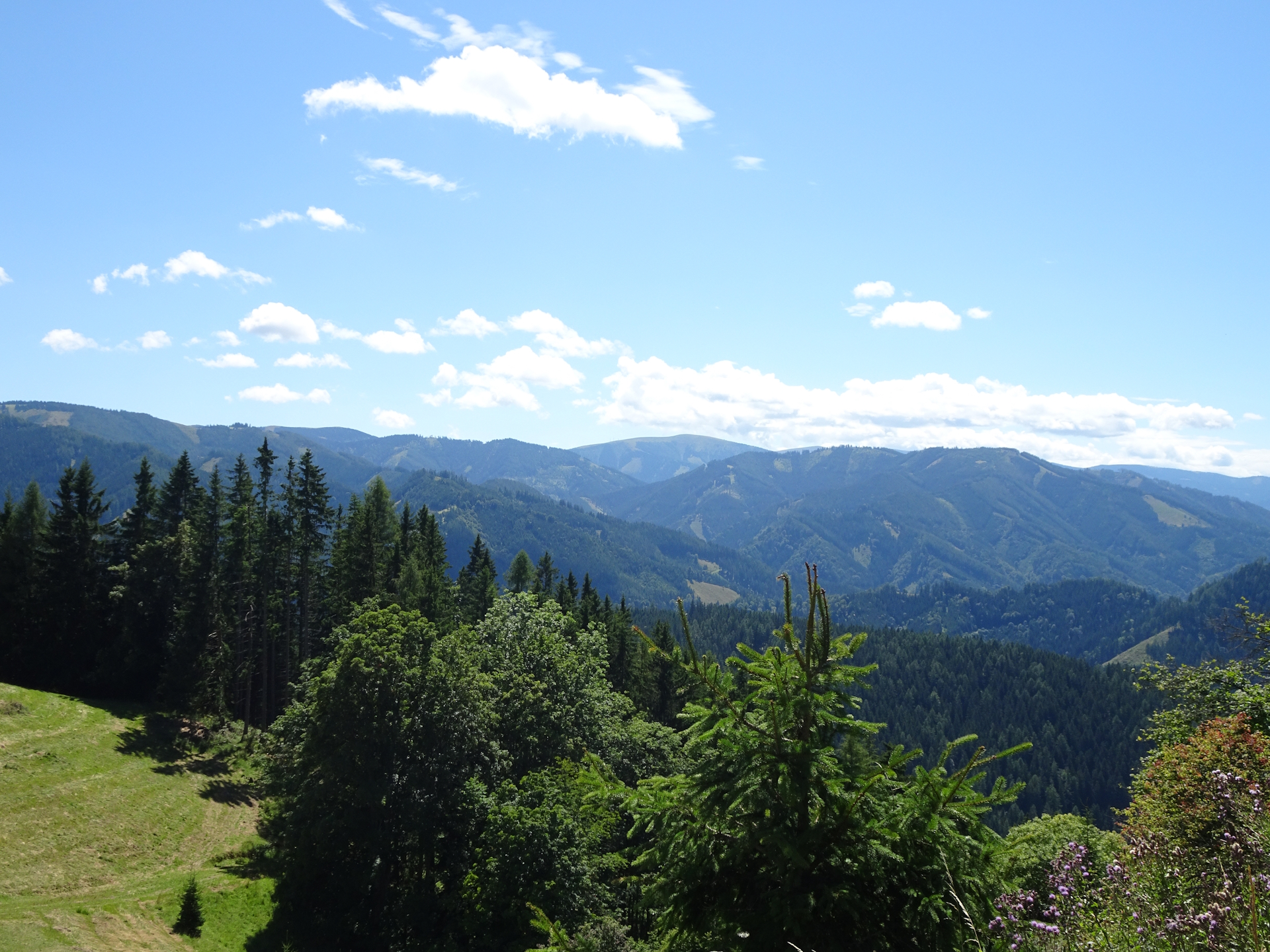
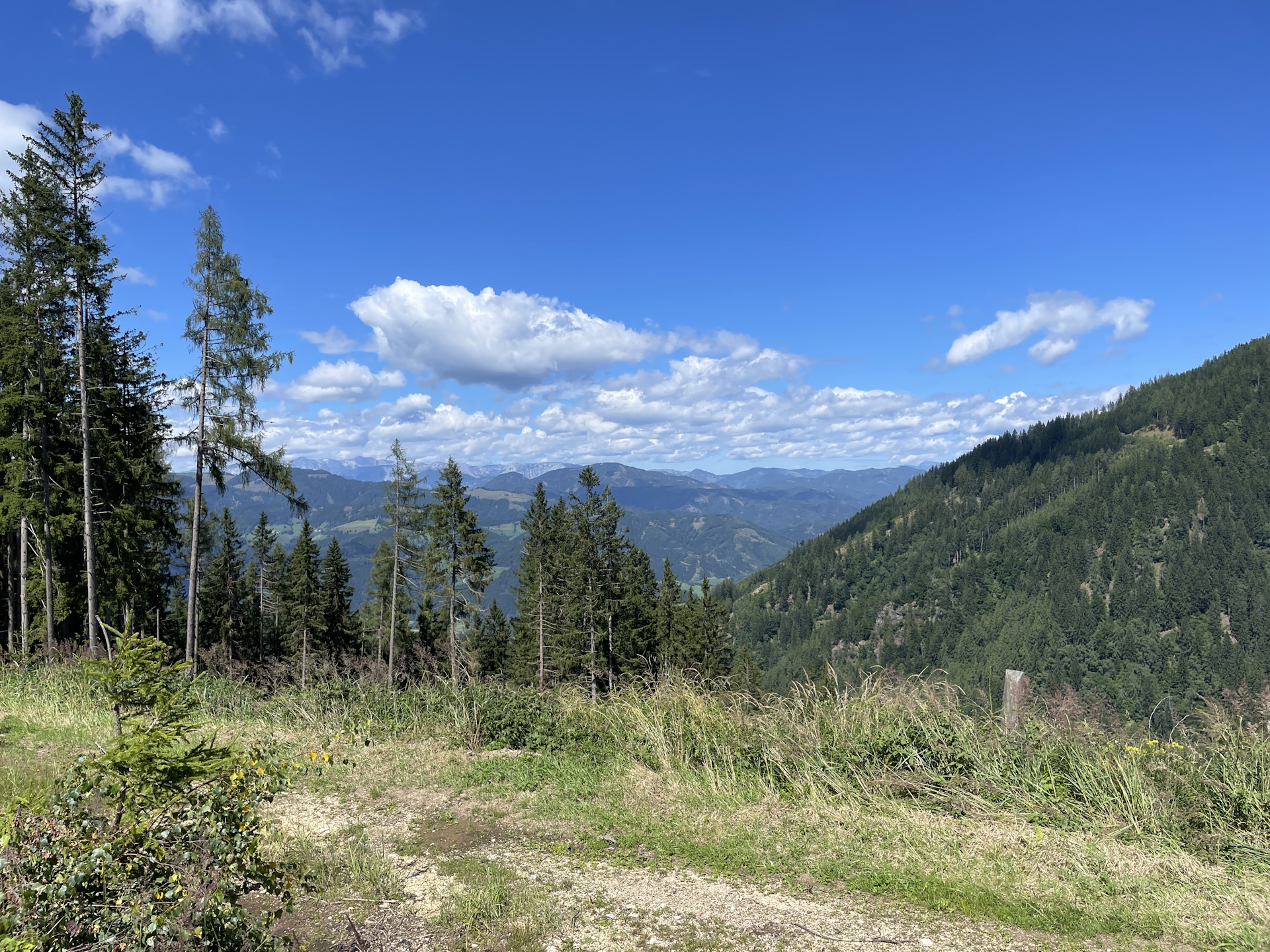
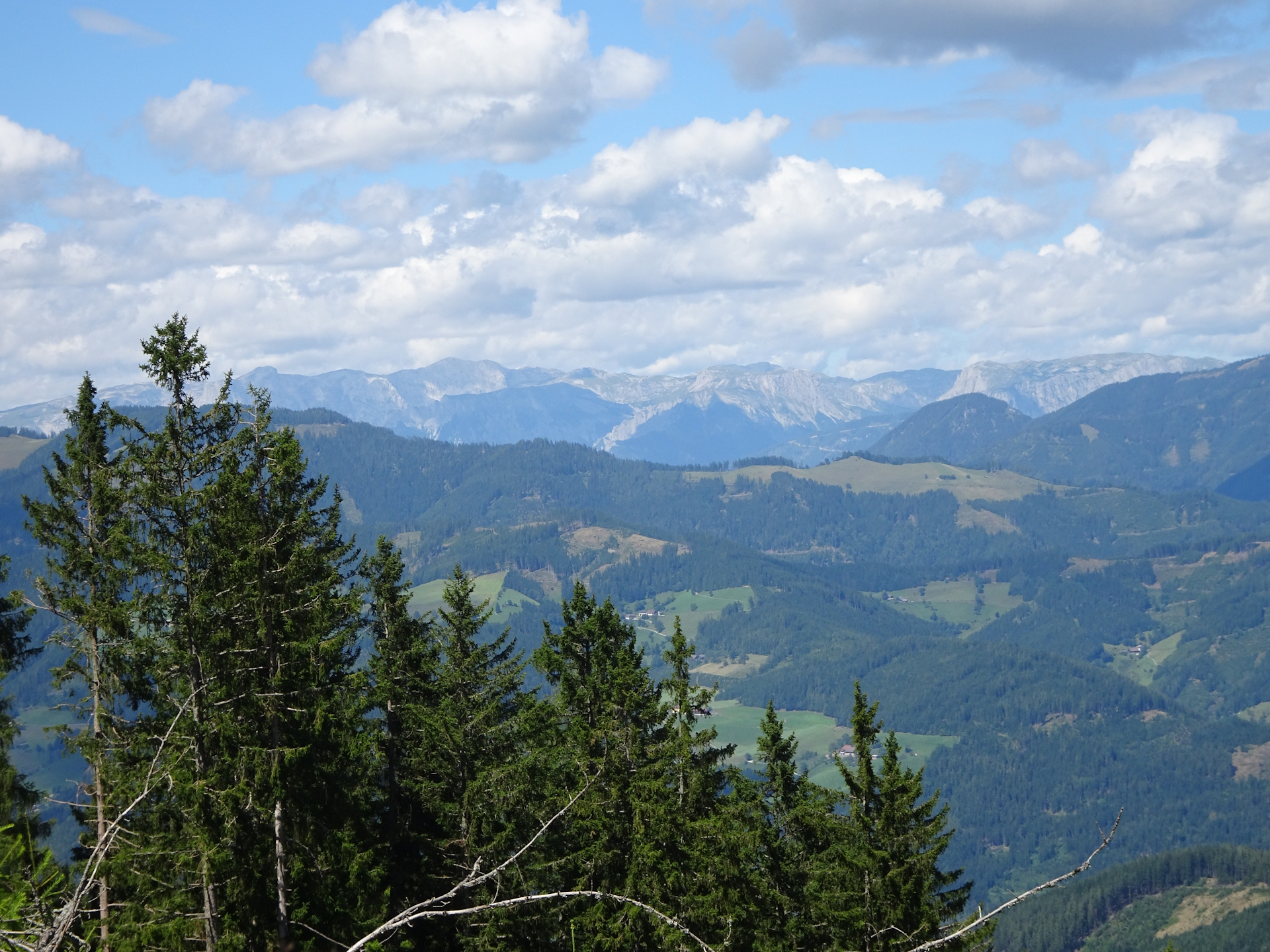
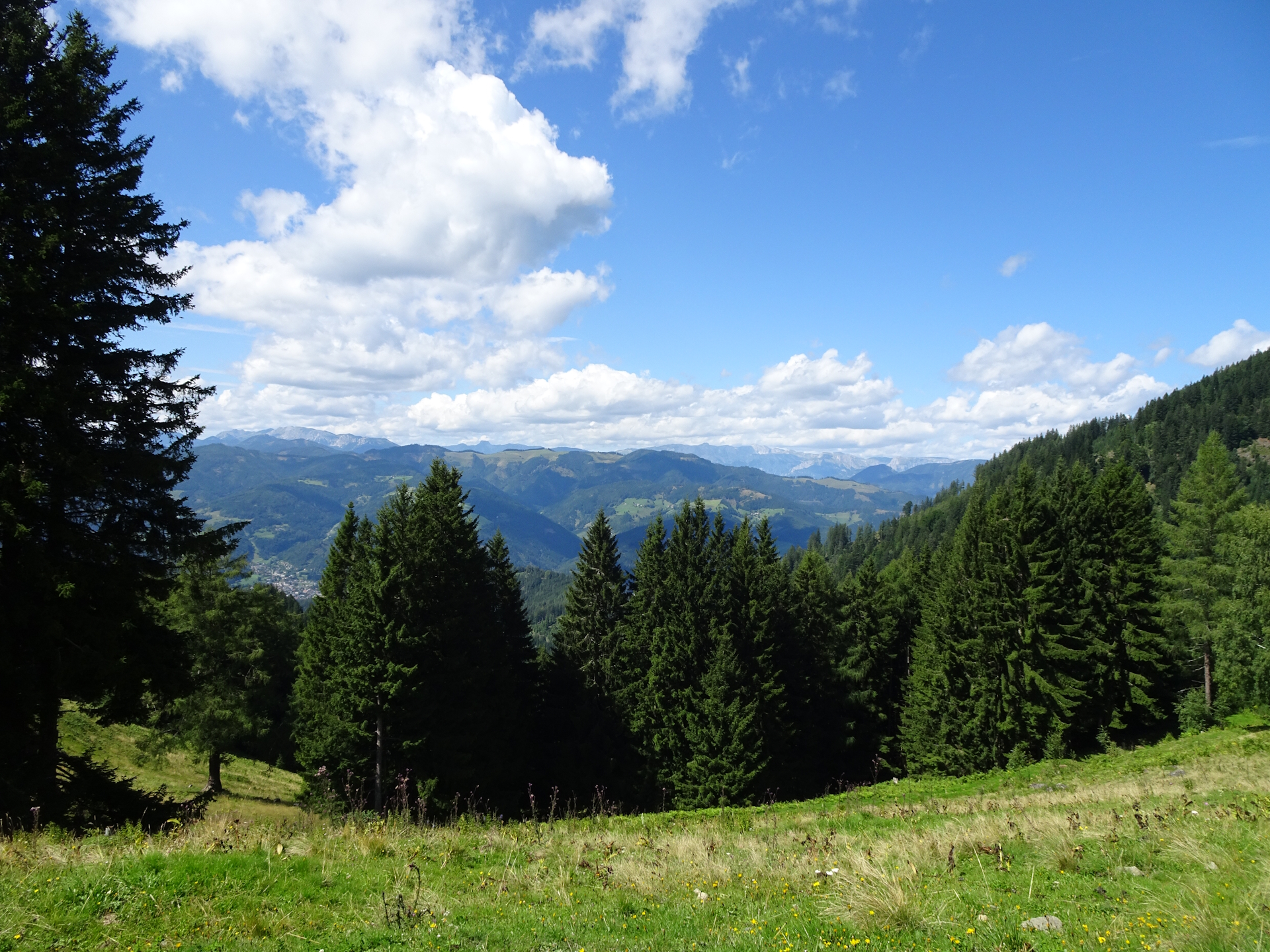
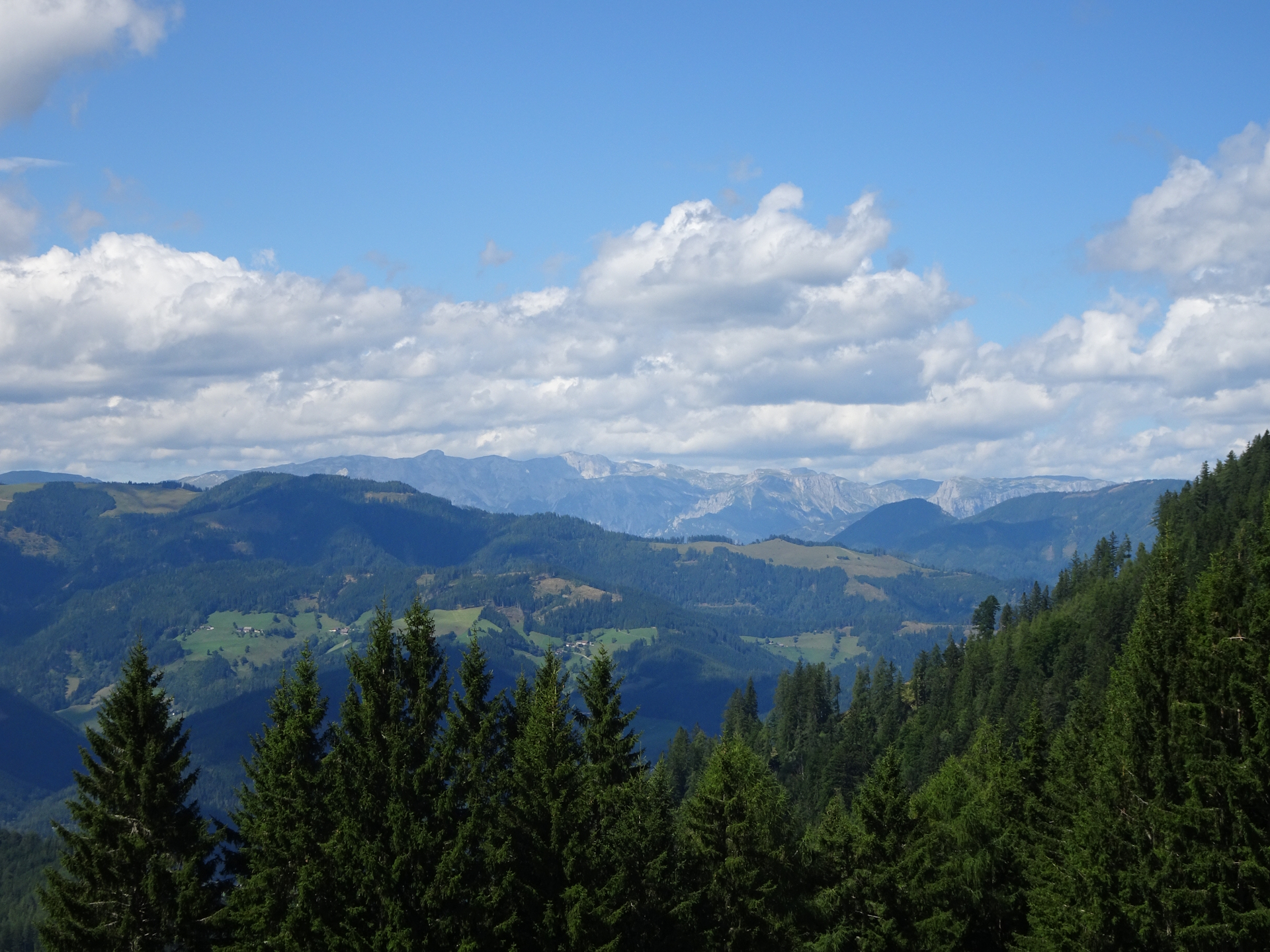
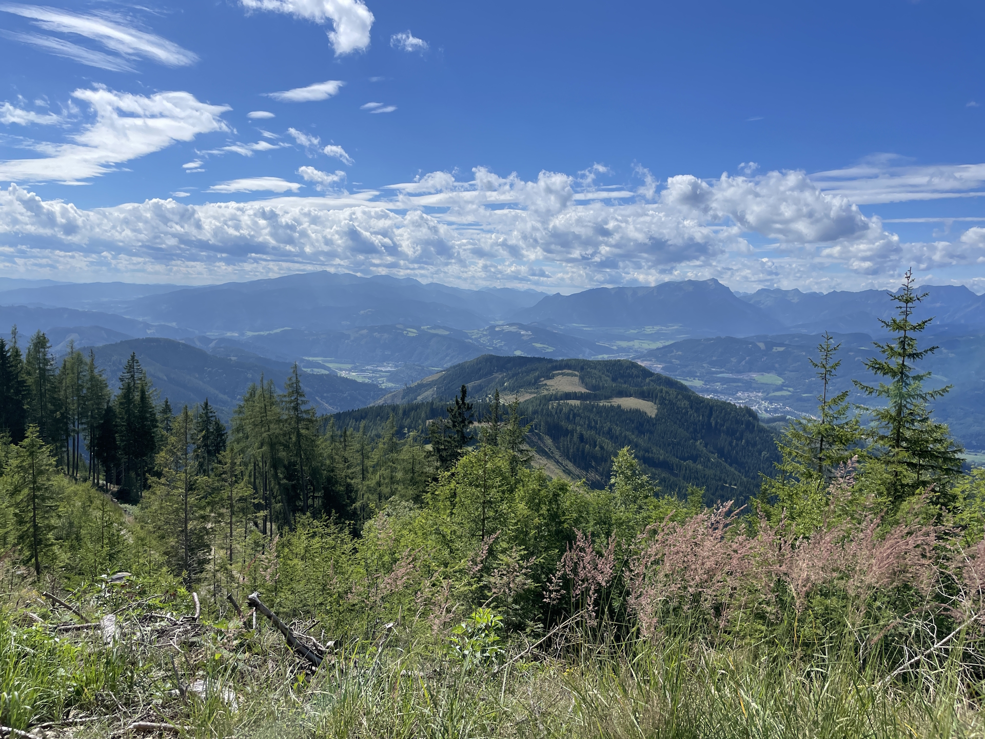
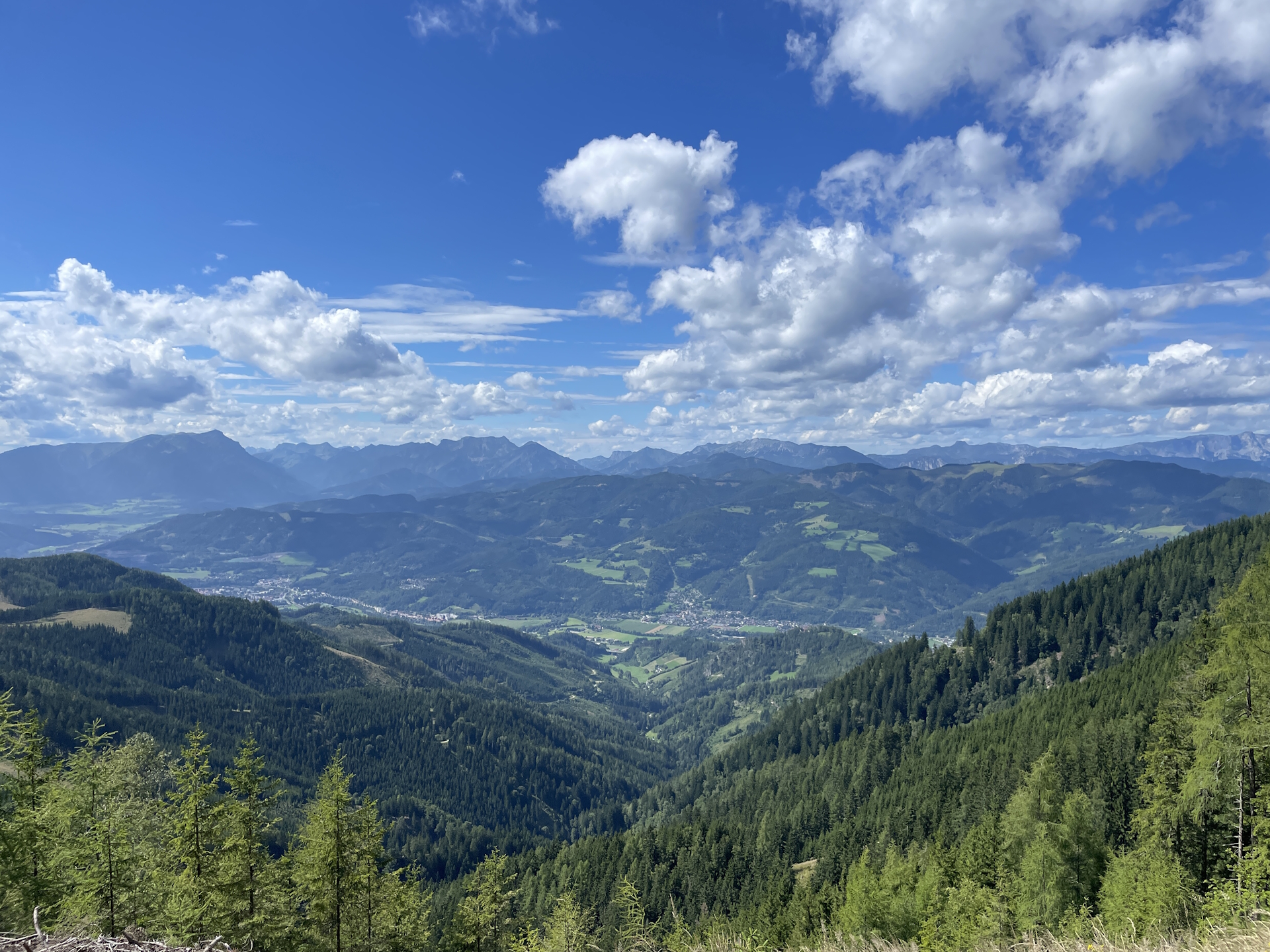
The tour starts at the train station Leoben Hauptbahnhof and immediately crosses the Mur river and continues following the street into the city center. At the main square right at the Pestsäule, the tour then turns left and then right and then follows the official 05 trail southwards. After crossing the main street (Kärtnerstraße), the tour then ascends up to the Maßenburg castle and its recommended viewing platform. After enjoying the view towards the city of Leoben but also the surrounding mountain scenery, the tour then follows the marked trail eastwards to Schmollhube / Mugel. The tour mainly follows trails and gravel roads through the forest, so also on very hot days the tour here is enjoyable. just before reaching the Pampichler Warte, the tour turns left and continues following the marked trail towards Schmollhube.
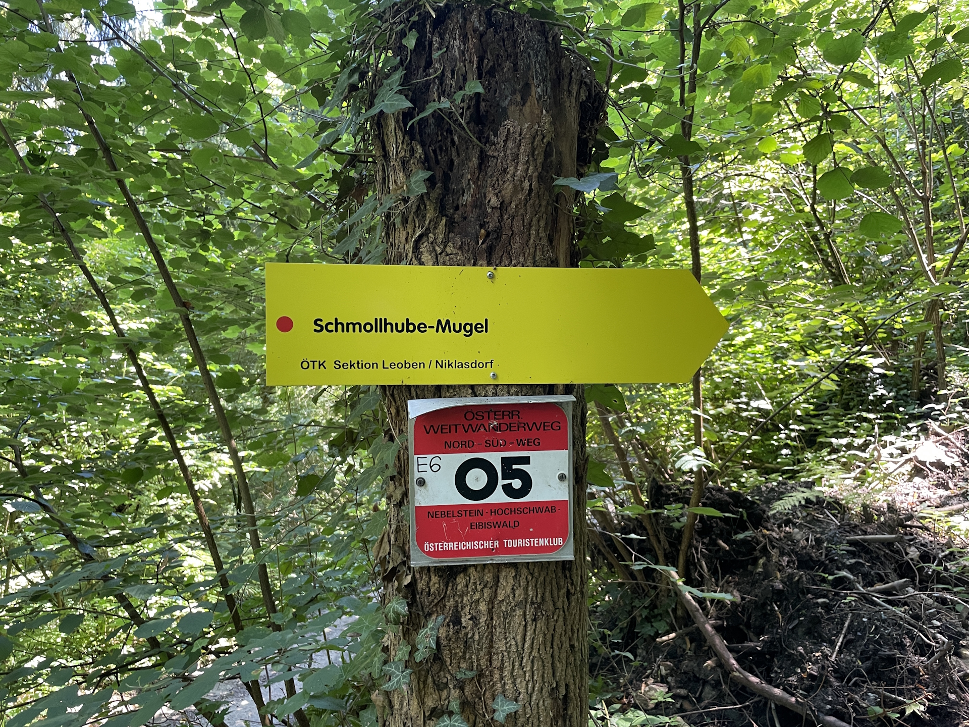
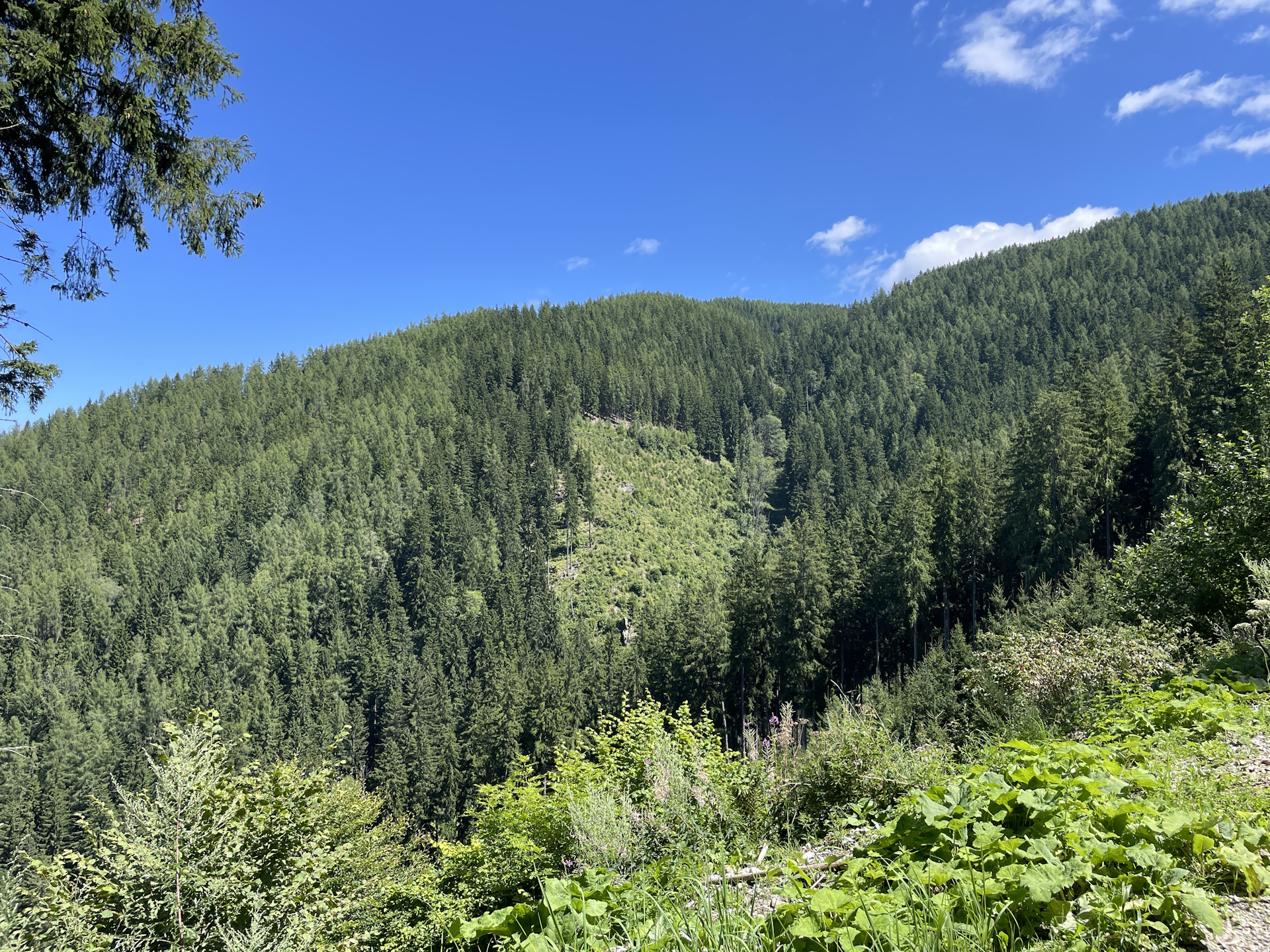
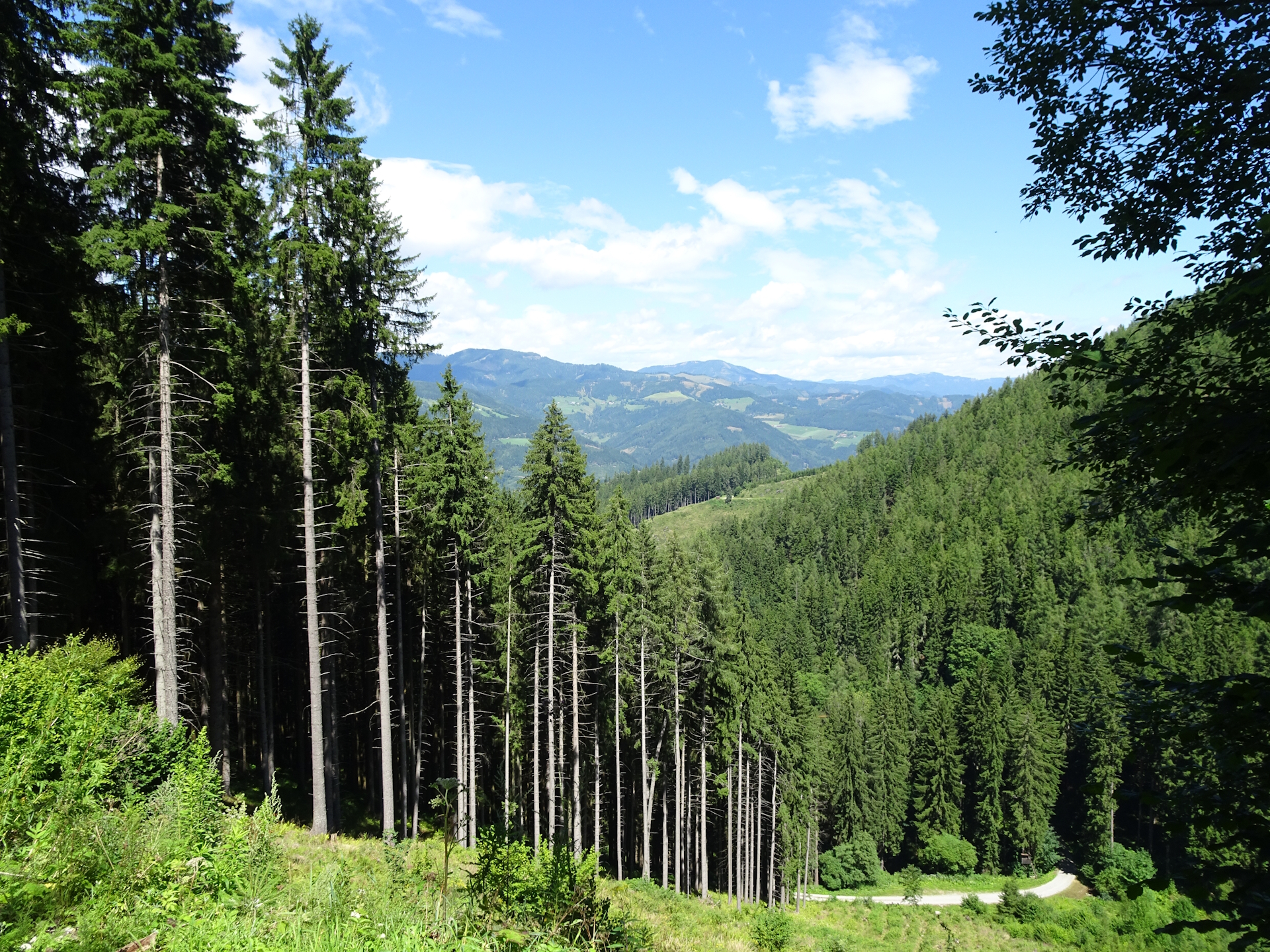
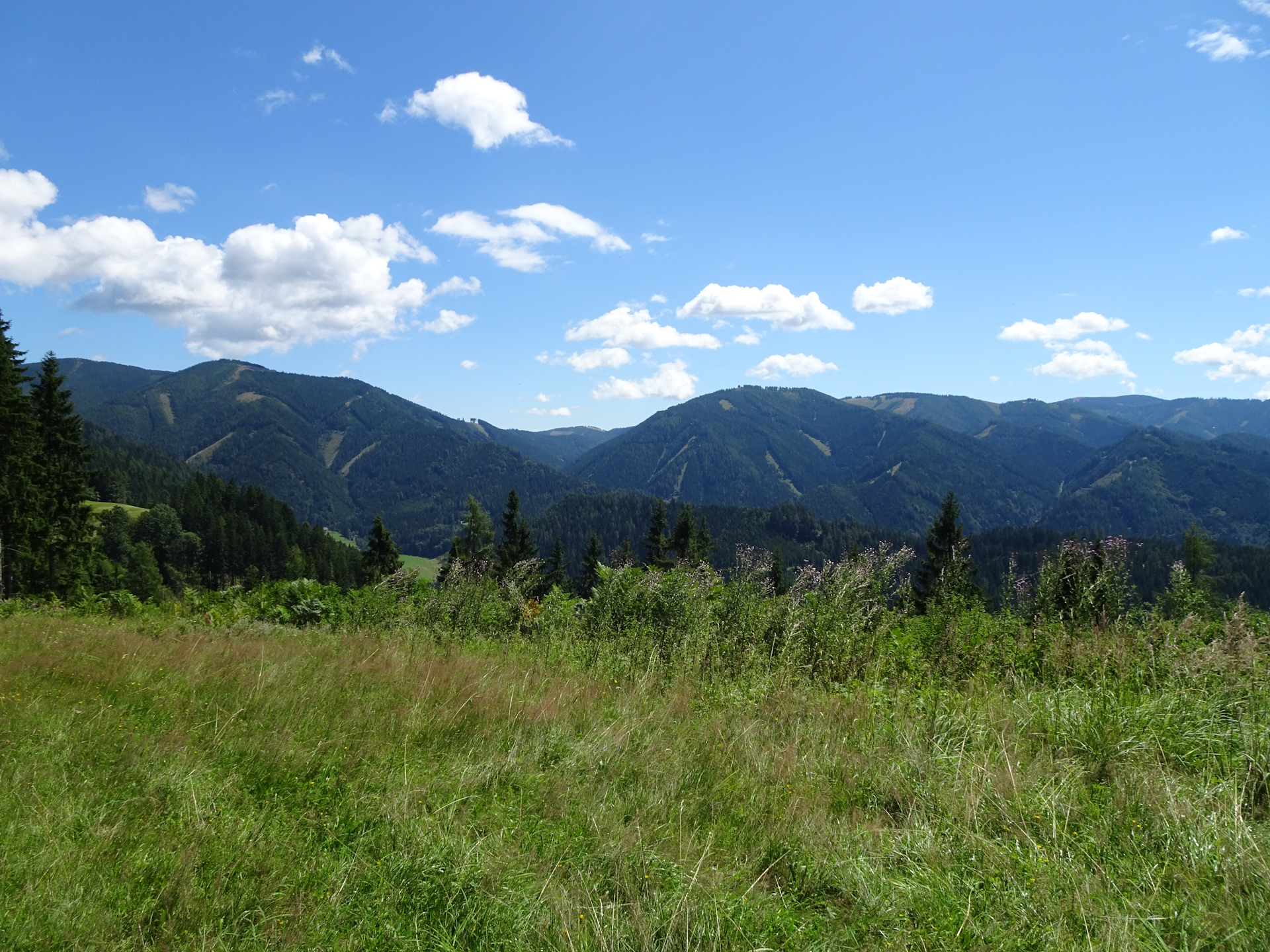
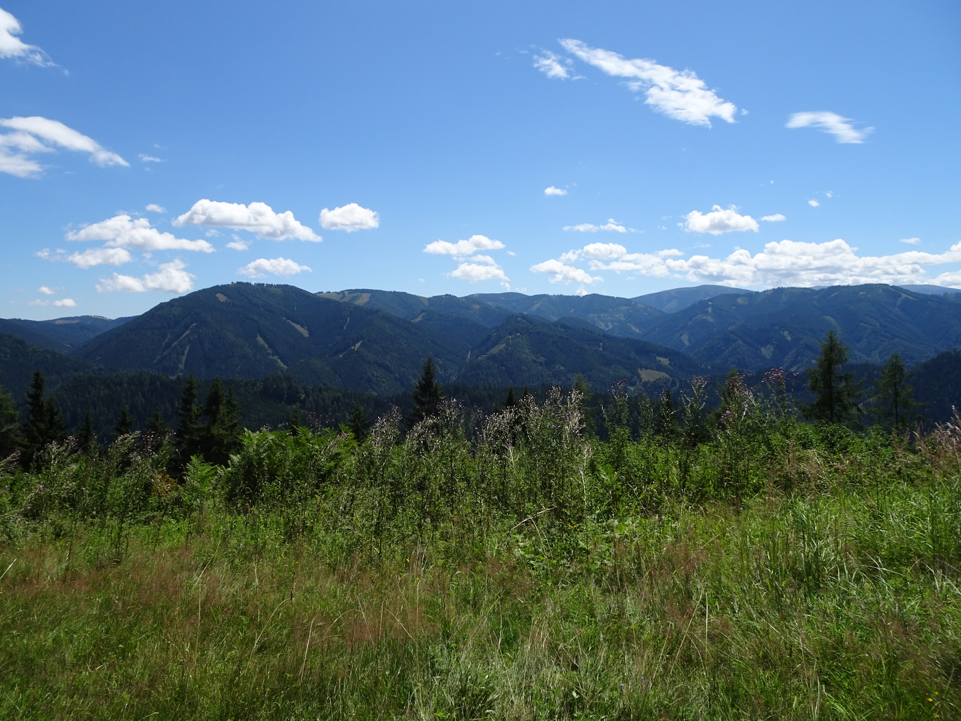
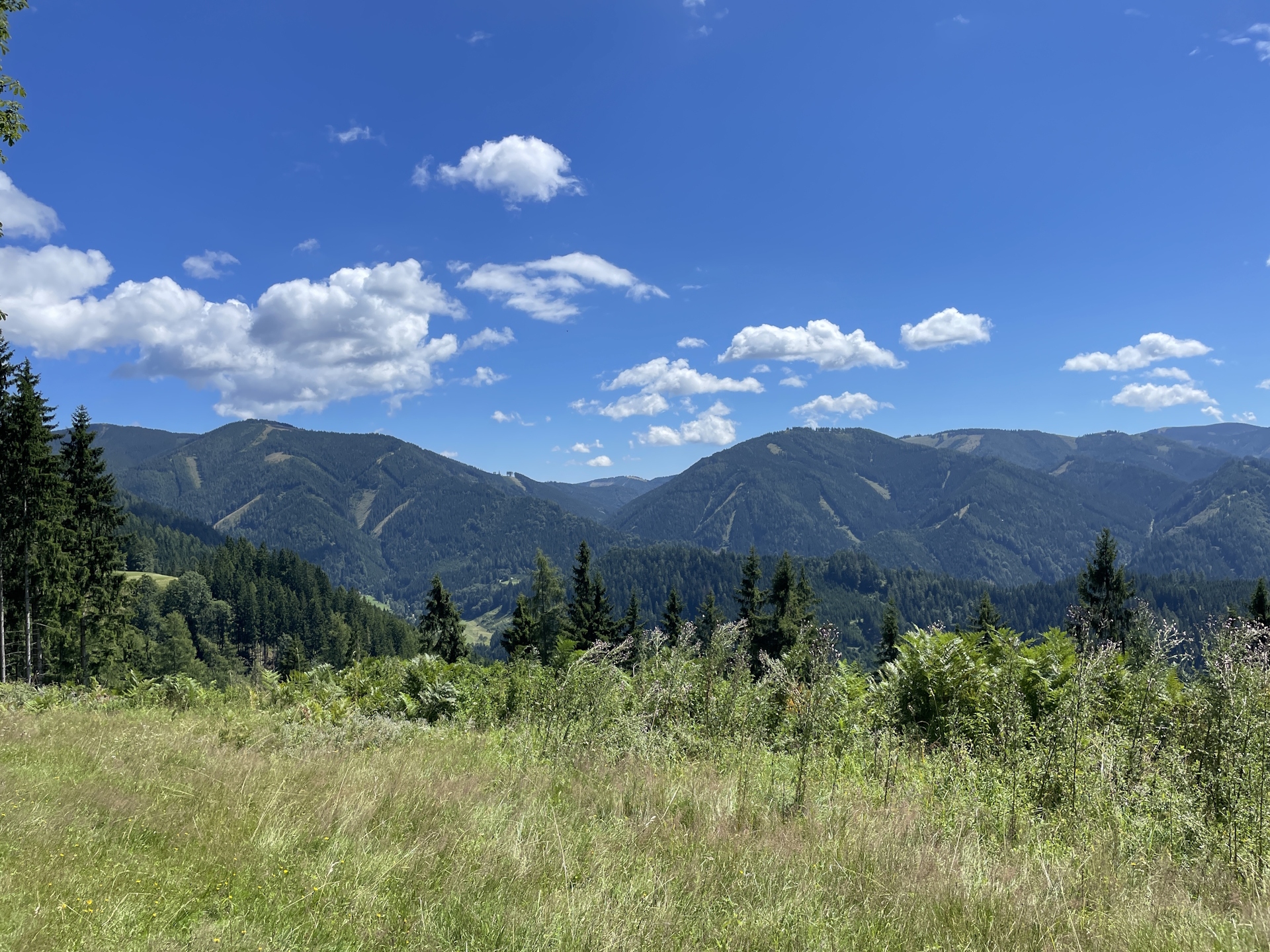
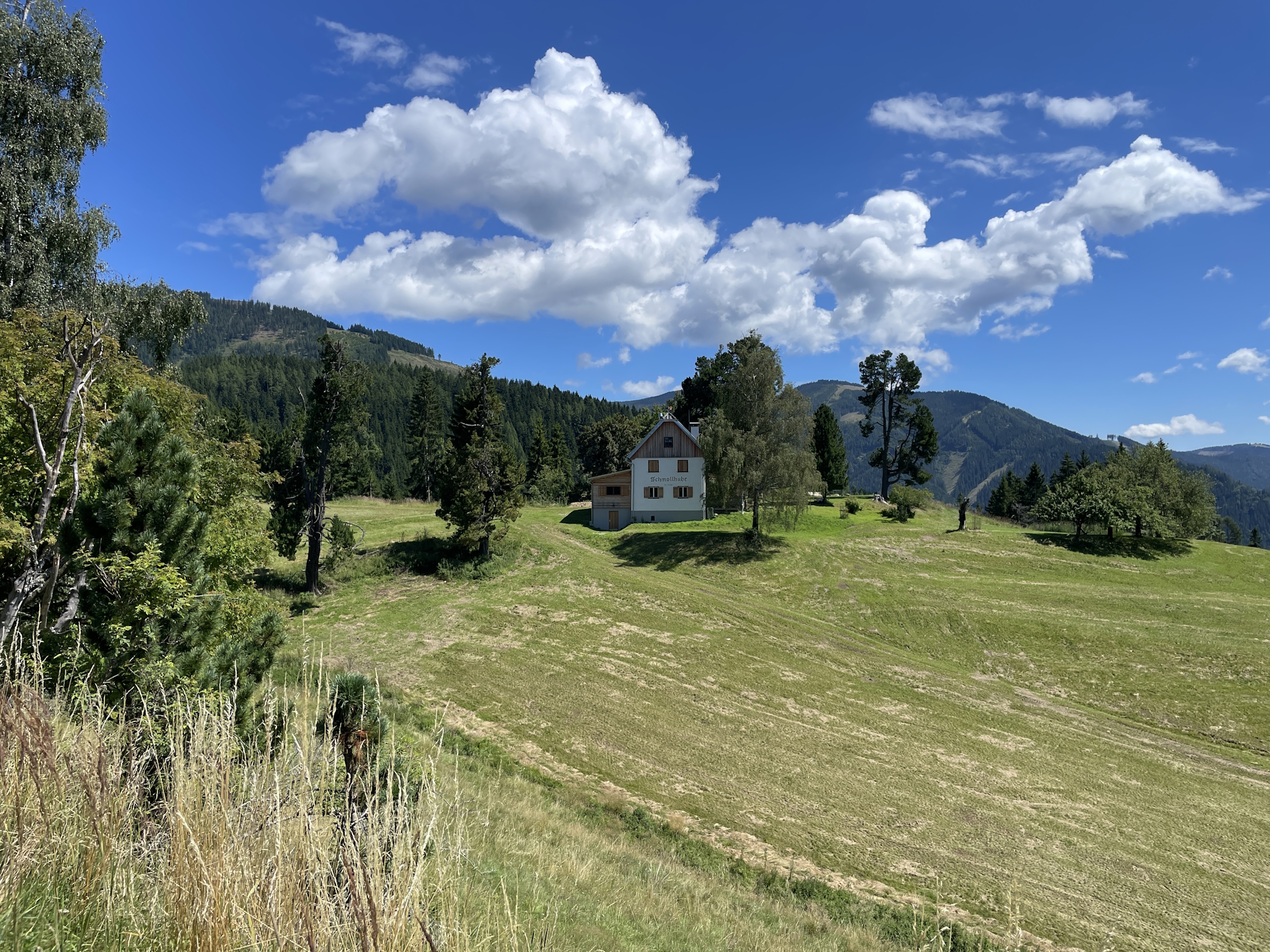
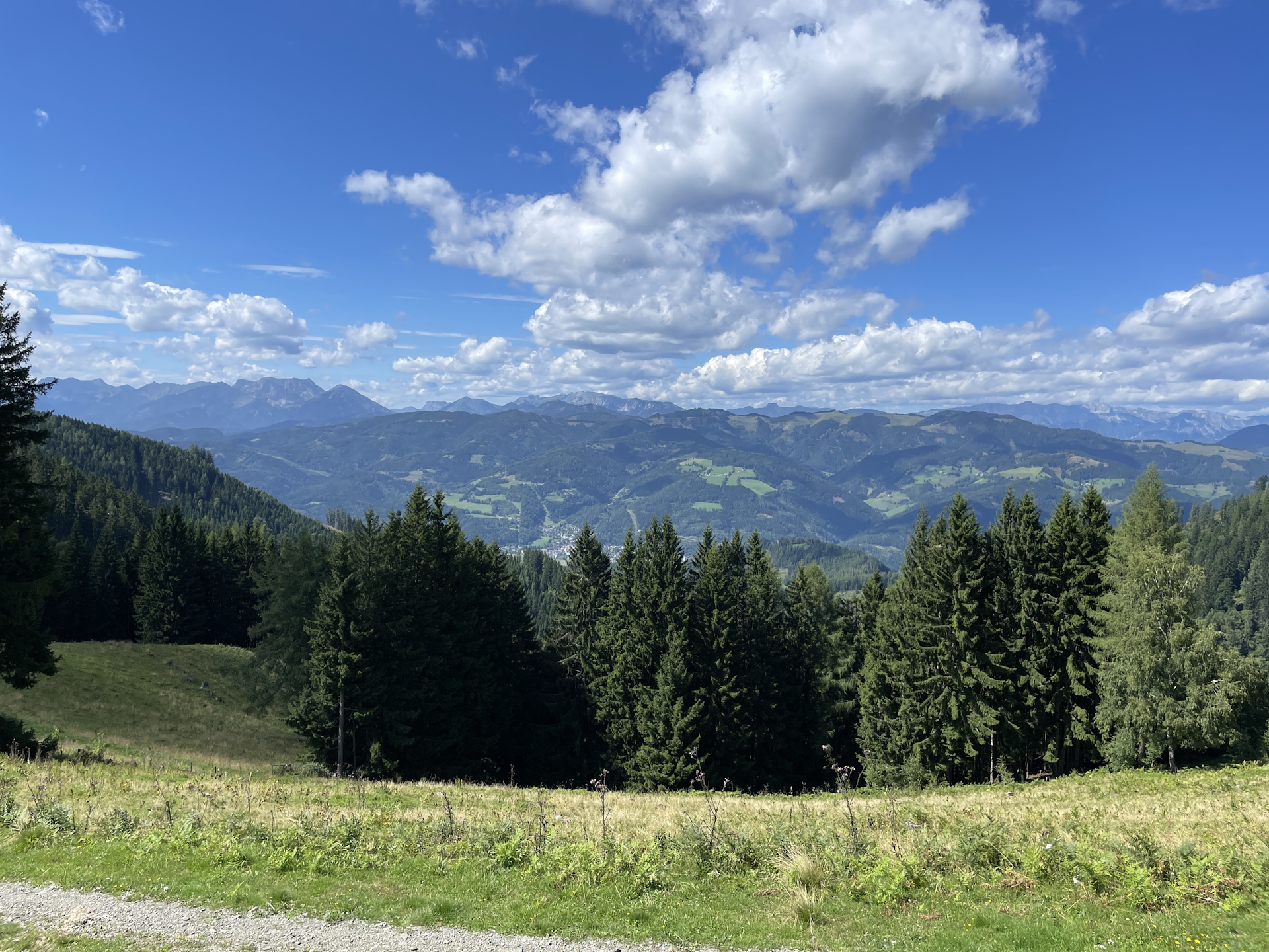
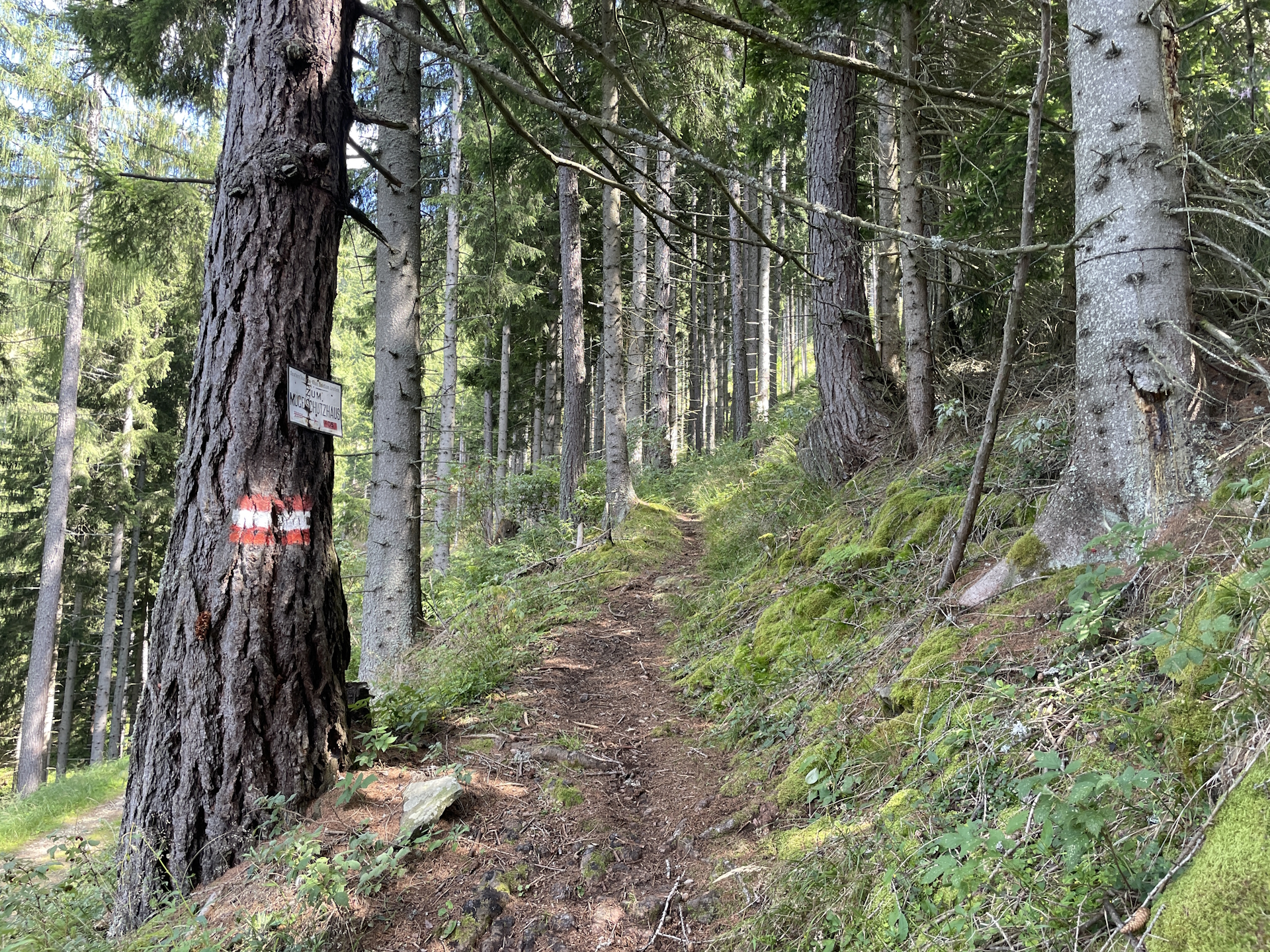
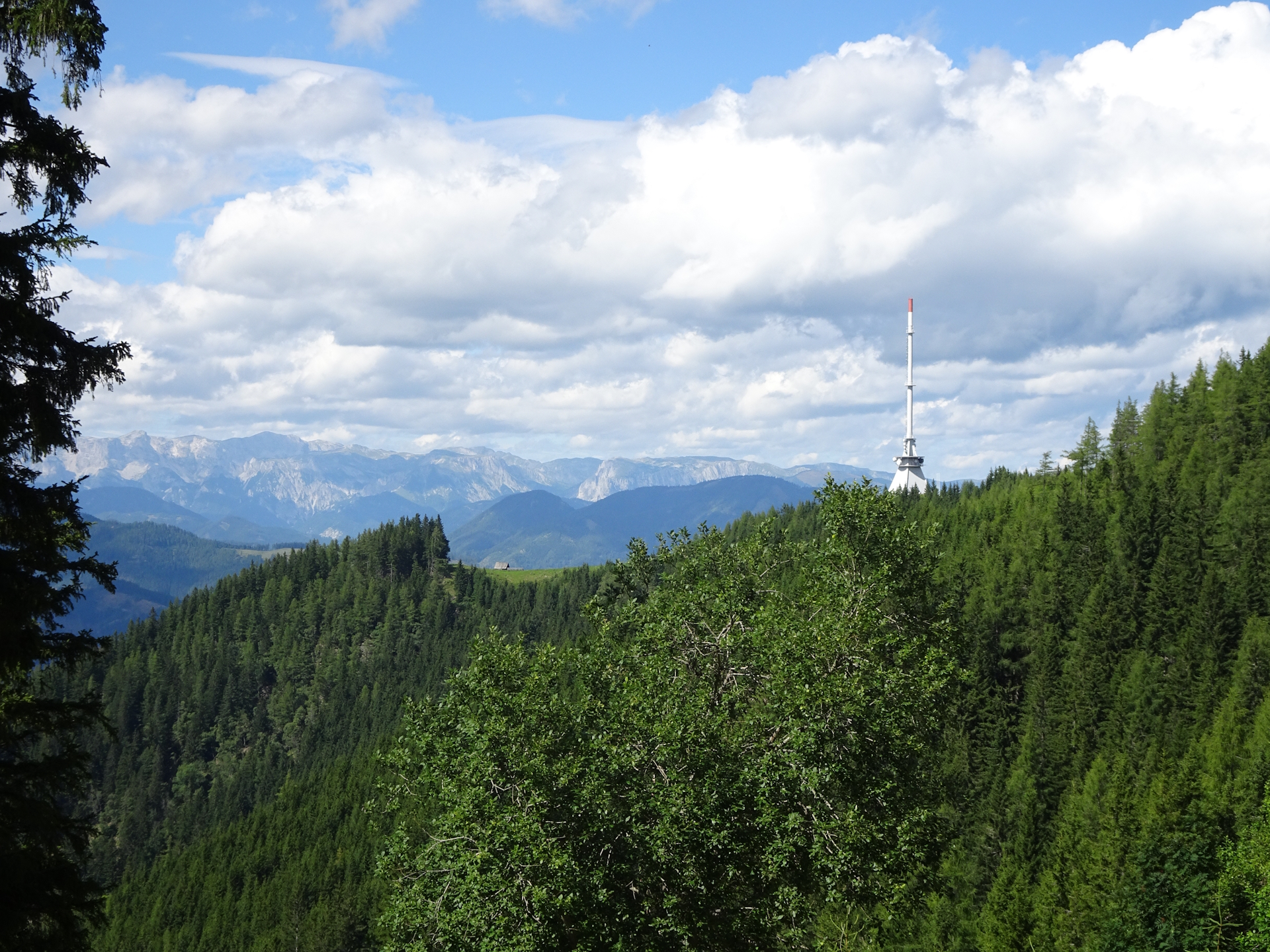
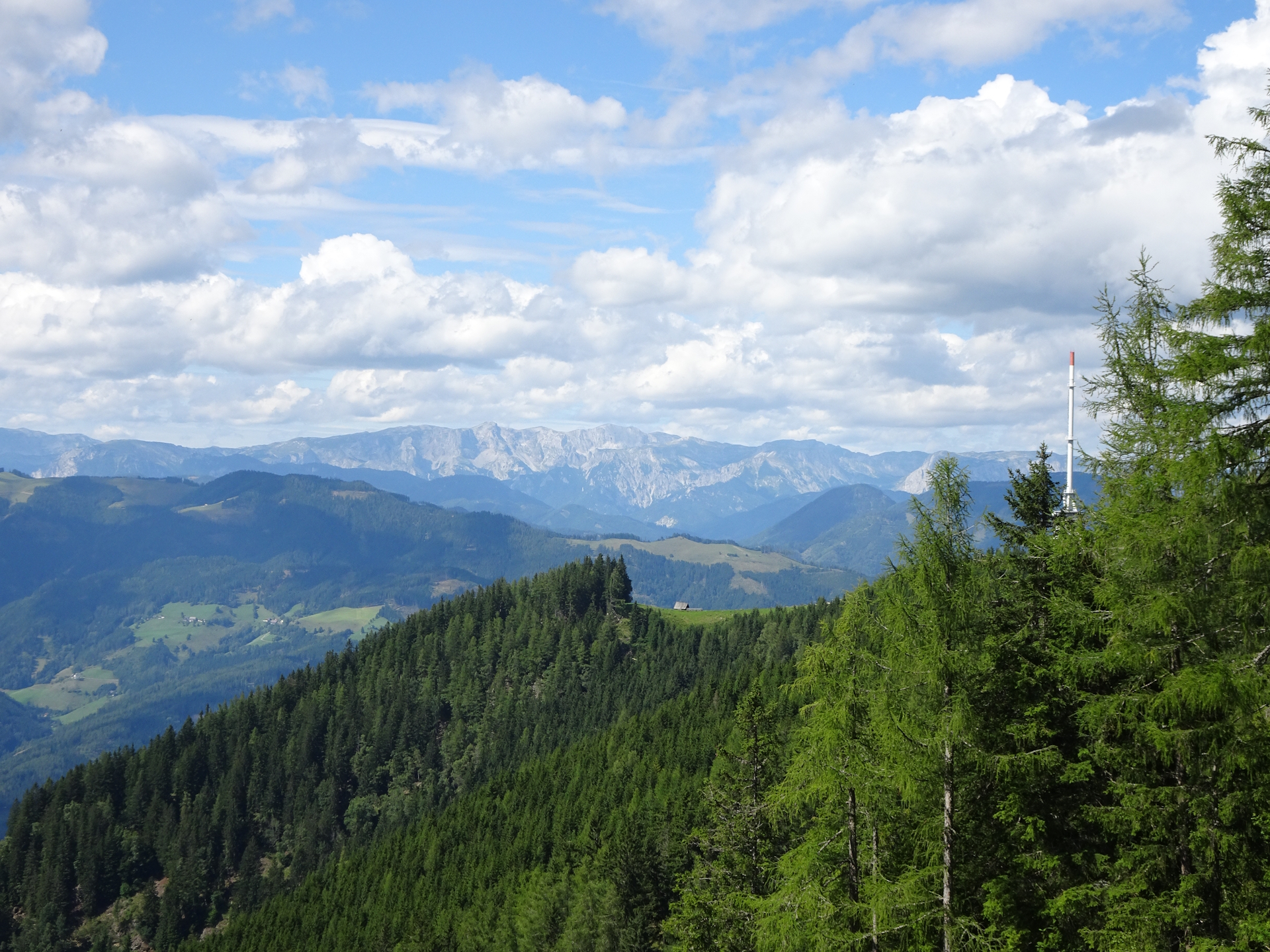
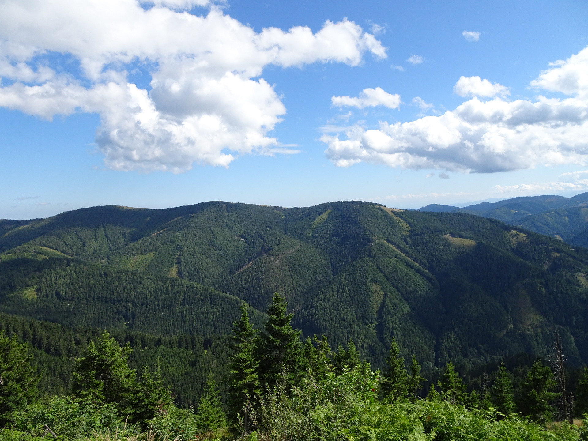
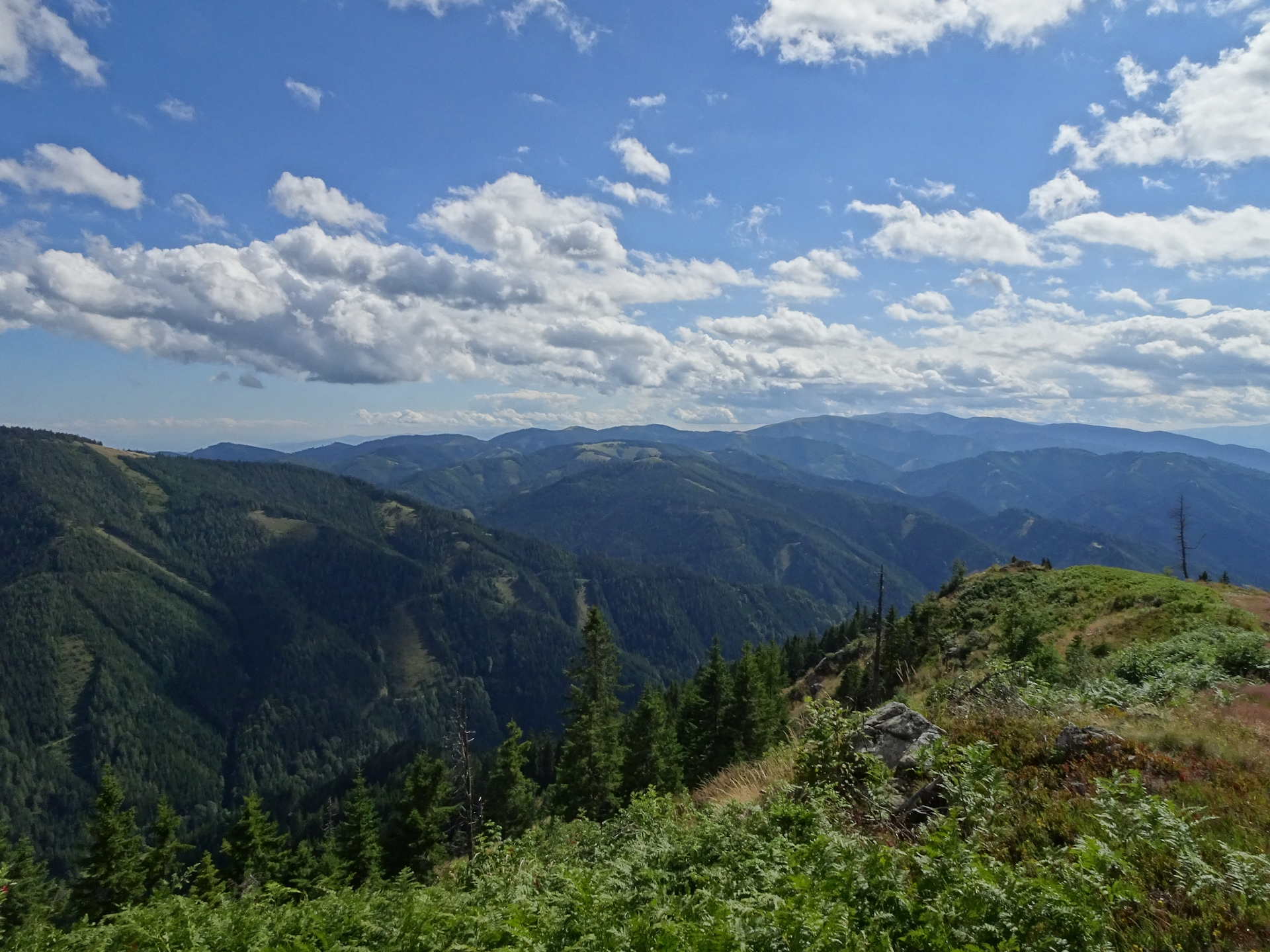
After passing by Schmollhube, the tour then follows a gravel road eastwards towards Mugel. The tour first still follows a fairly easy gravel road till reaching the Gstattmoaralm. It is recommended to consider here a final break before the tour then follows a fairly steep path up that directly ends at the summit of Mugel and the Mugelschutzhaus (Checkpoint) hut next by.
| Nord-Süd-Weitwanderweg 05 – Checkpoints | |
|
Transportation:
I’ve planned to accomplish this stage as the first of an 8-day multi-day trip, starting in Leoben and making it all the way till Eibiswald. This meant that I had the full backpack with clothing for 8 days and the equipment for overnight stays at huts.
As the weather forecast was to be very hot but at least dry over the next days and since I did a lot of other trips on the Nordalpenweg 01 the week before, I planned to have a short and easy kickoff. Thus I planned for a half-day trip for this tour.
To get to the starting point I used the following means of transportation:
- Railjet 533 from Wien Hauptbahnhof (08:24) Leoben Hauptbahnhof (10:24)
The hike:
I’ve planned this stage as the kickoff of an 8-day multi-day trip, thus I planned for a shorter trail. The reason was that the week before, I just came back from a multi-day tour doing the Nordalpenweg 01 and also did the day before the previous stage. I used the night back home to get fresh cloths and prepare for the longer trip. In addition, I got aware that I had to replan my next stages due to the fact that the Gleinalmschutzhaus was not serviced and thus it would be impossible to have an overnight stay over there.
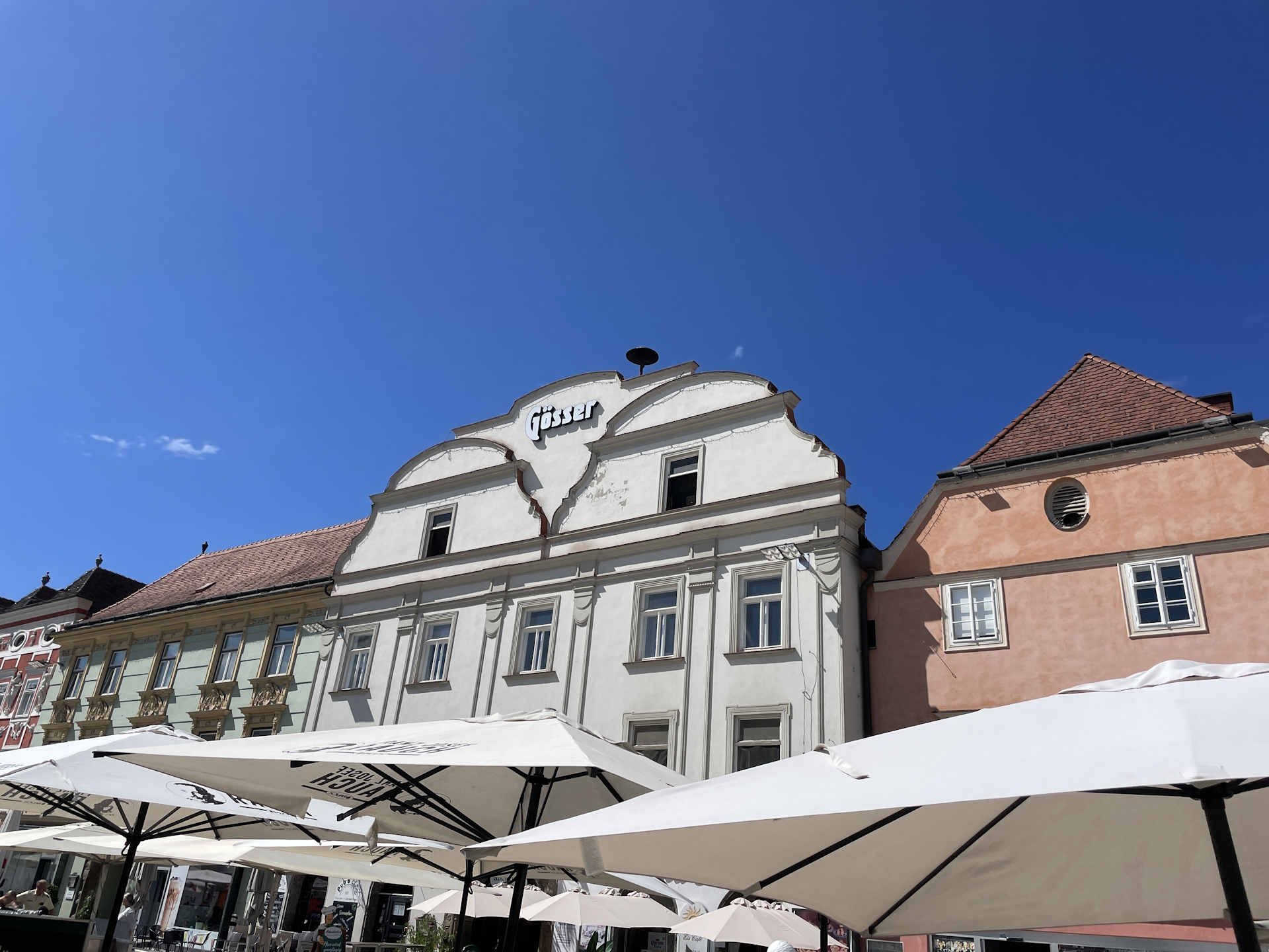
As I was not able to get a stamp on the day before in Leoben (for the first time the municipal office refused to provide me a stamp), I tried my luck this time at the tourism office and after a super nice chat with the ladies working there being interested in the details of the tour, I got my stamp without any problems .
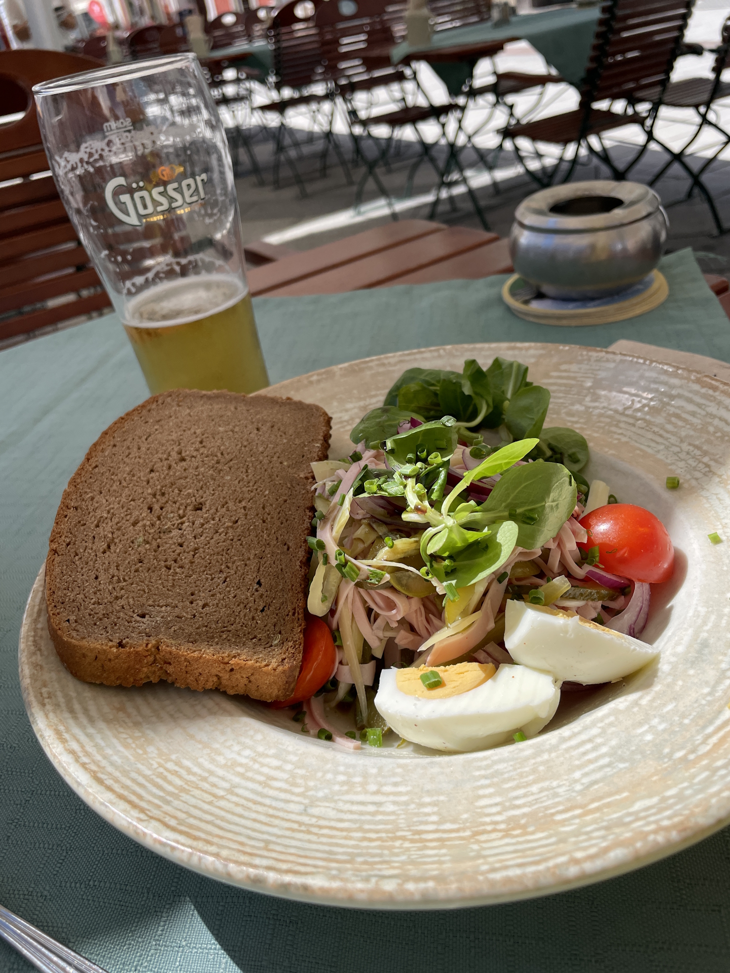
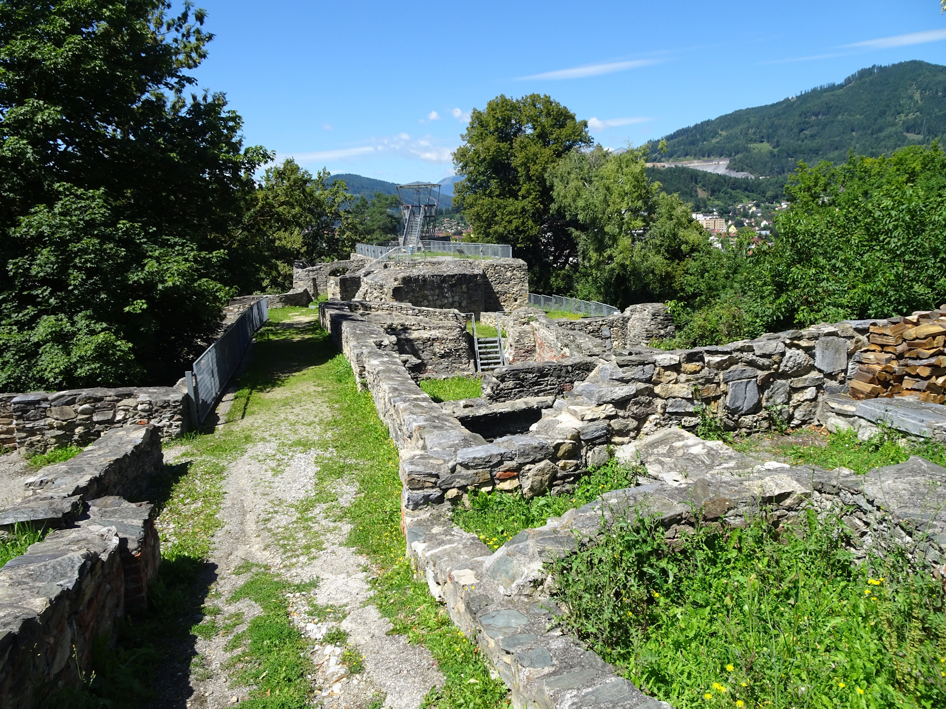
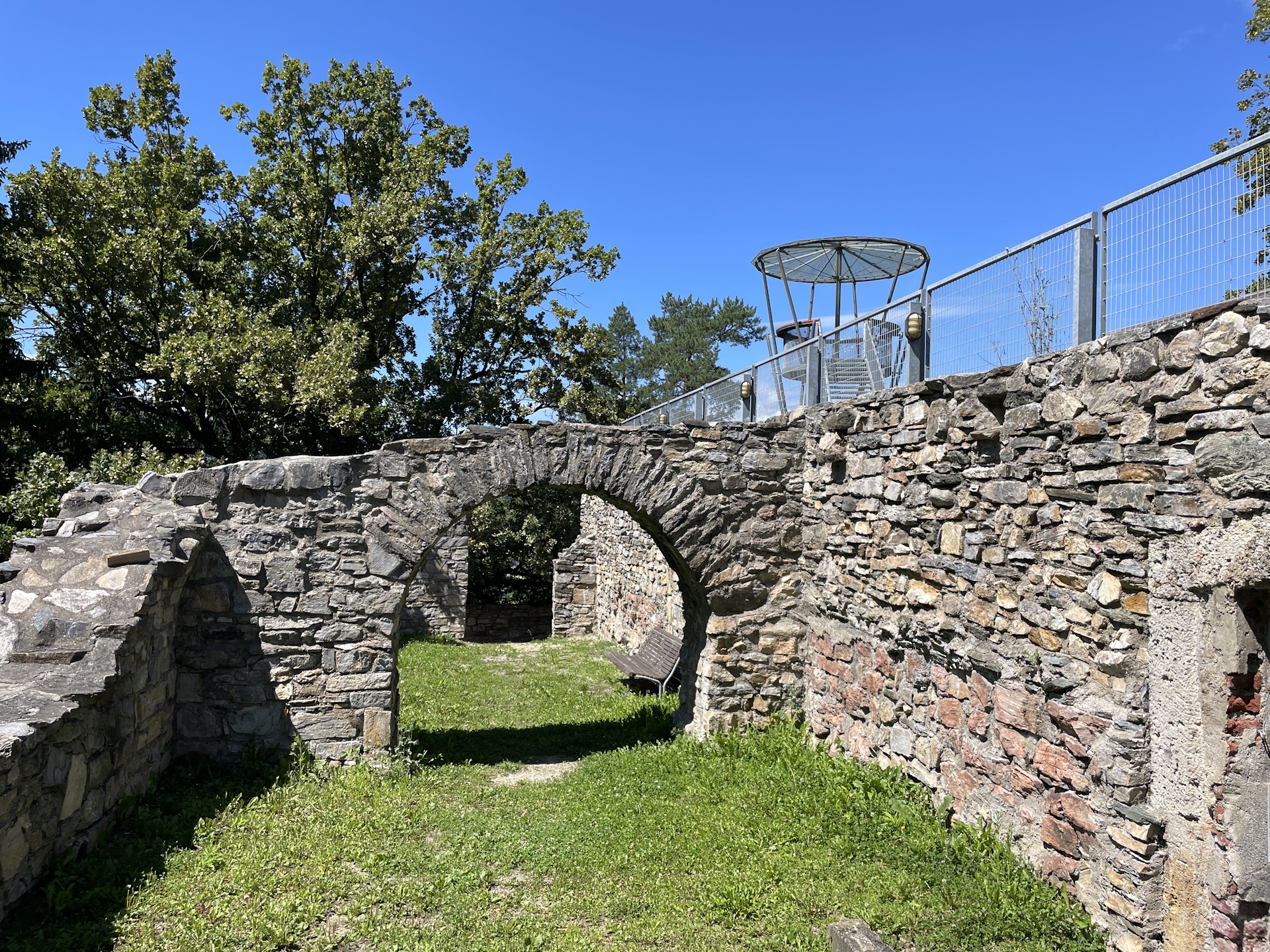
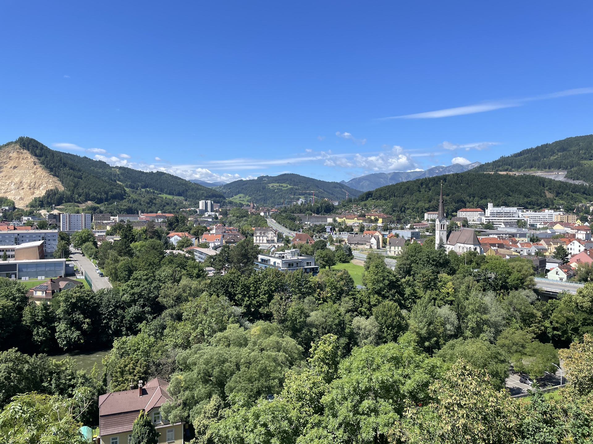
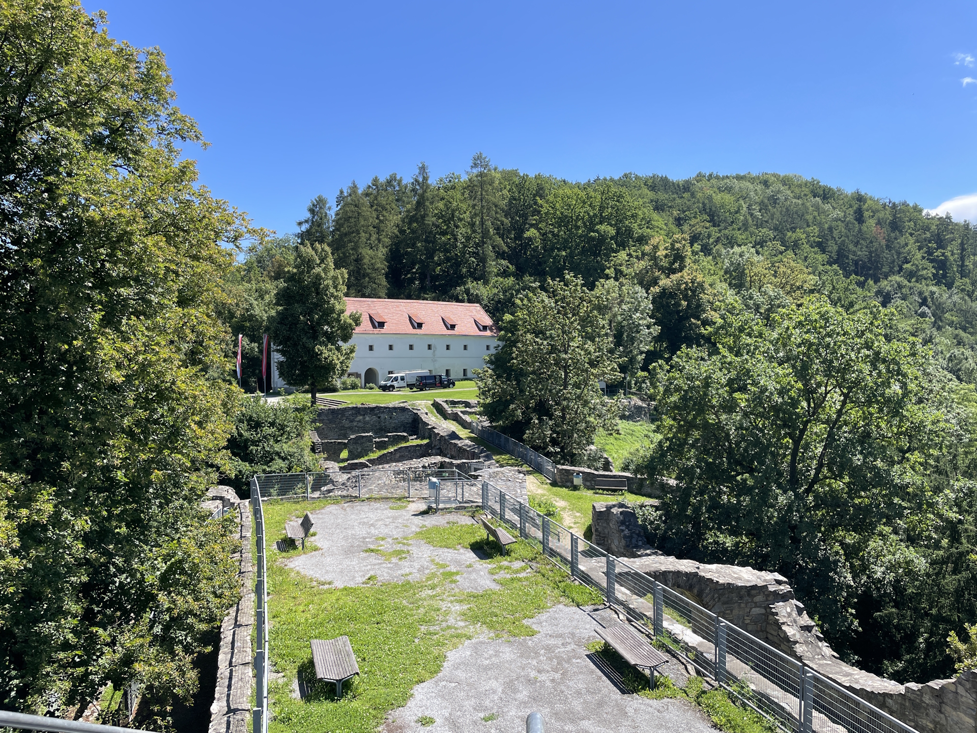
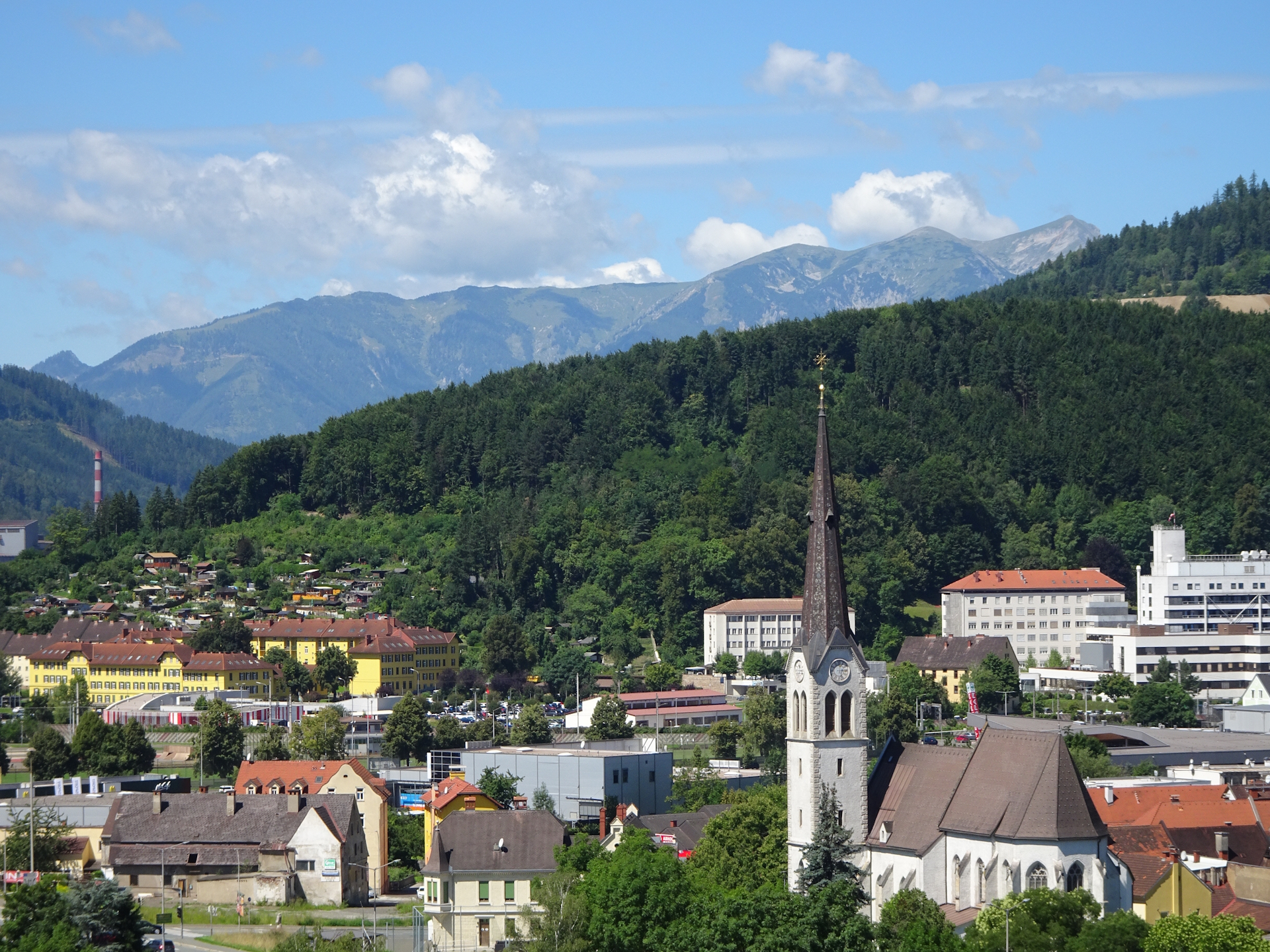
I also decided to have lunch at one of the restaurants in the city center and then started my hike by following the official trail first up to the Maßenburg castle. The castle itself was closed due to renovation but the more interesting viewing platform in the back was accessible and allowed me to have a stunning view on Leoben and its surrounding mountain scenery.
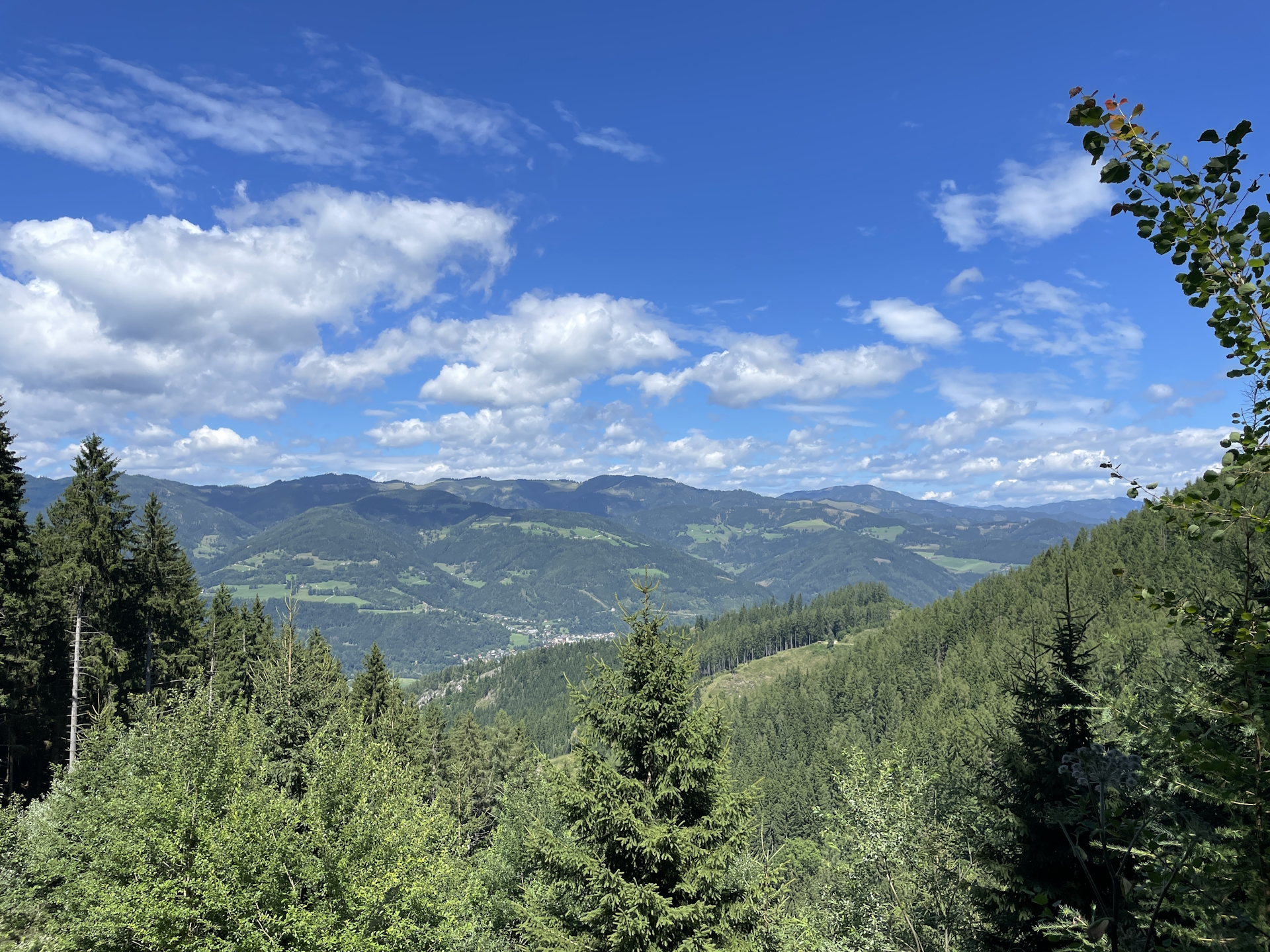
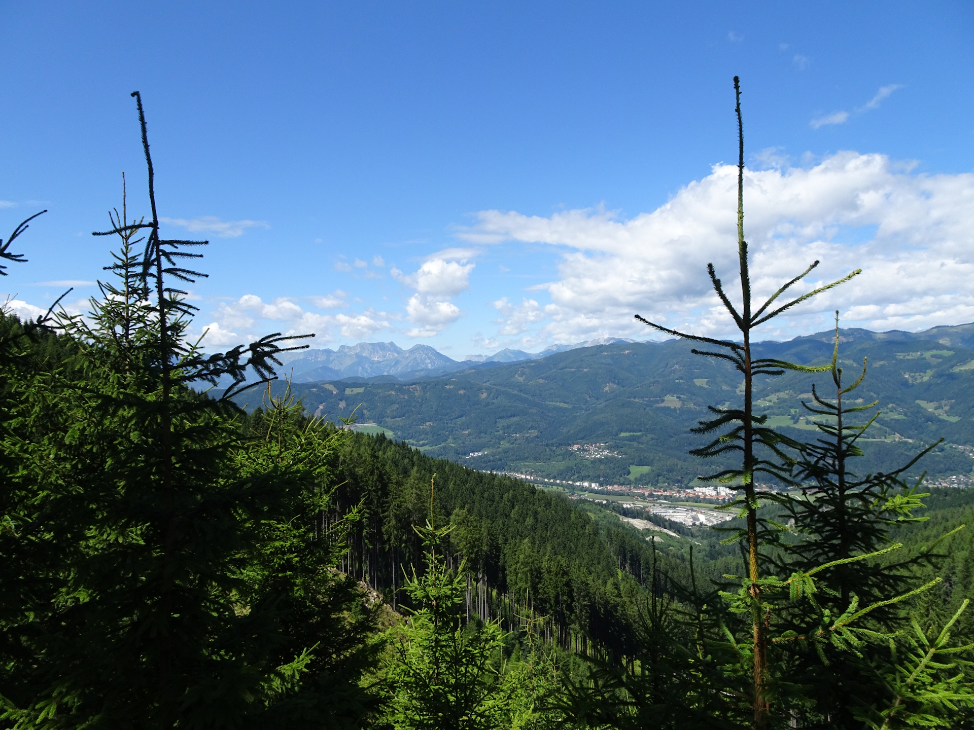
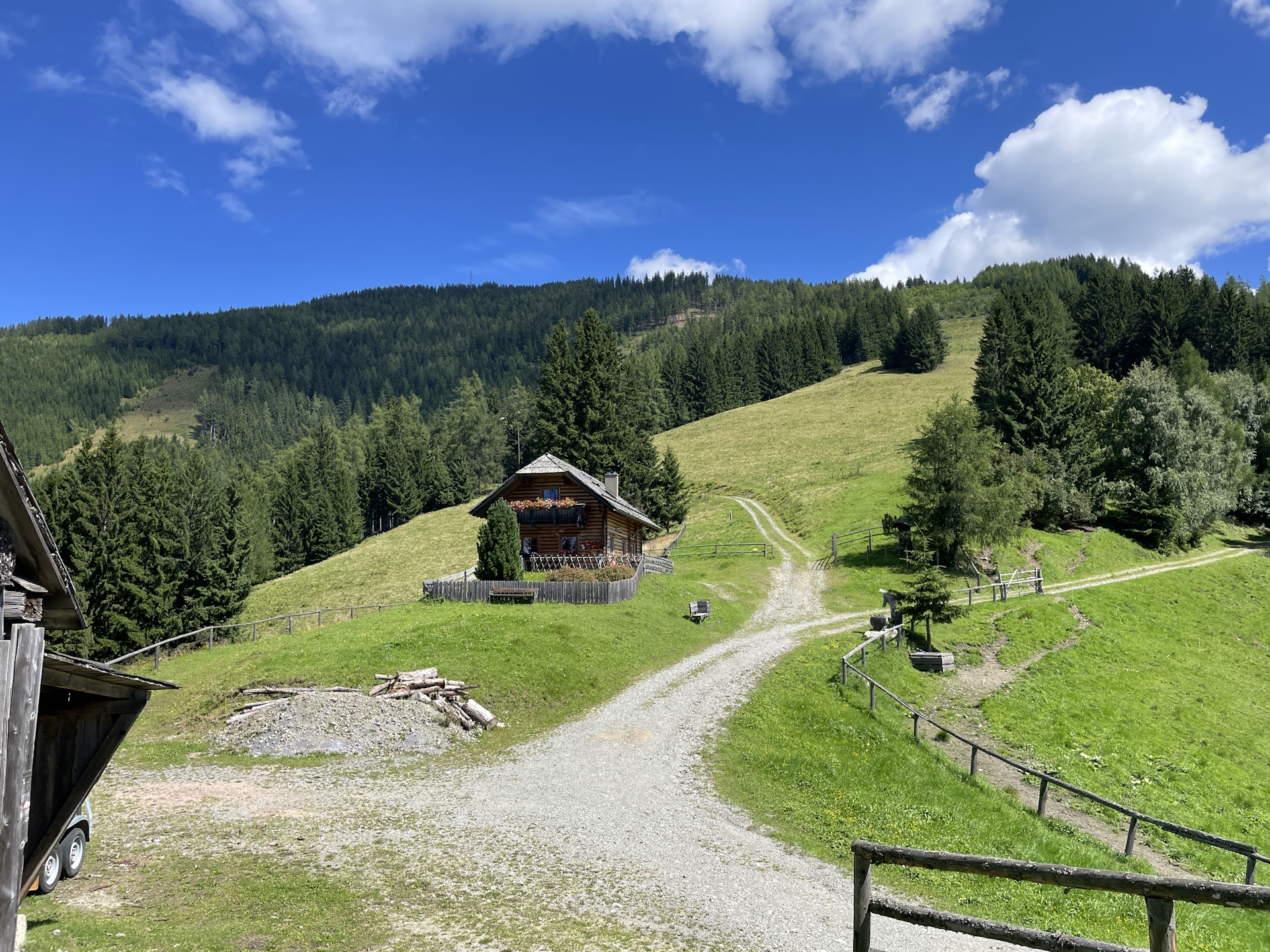
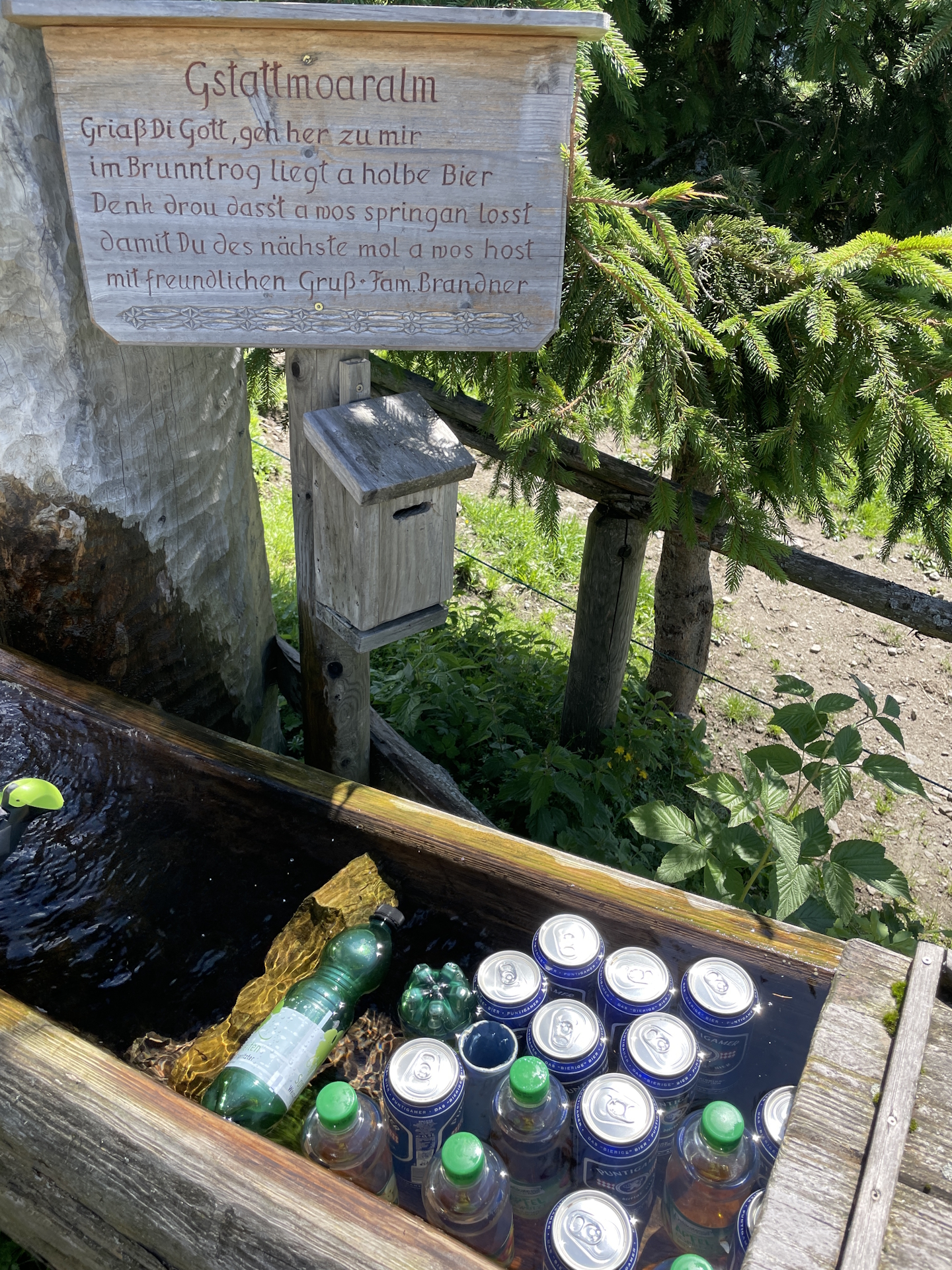
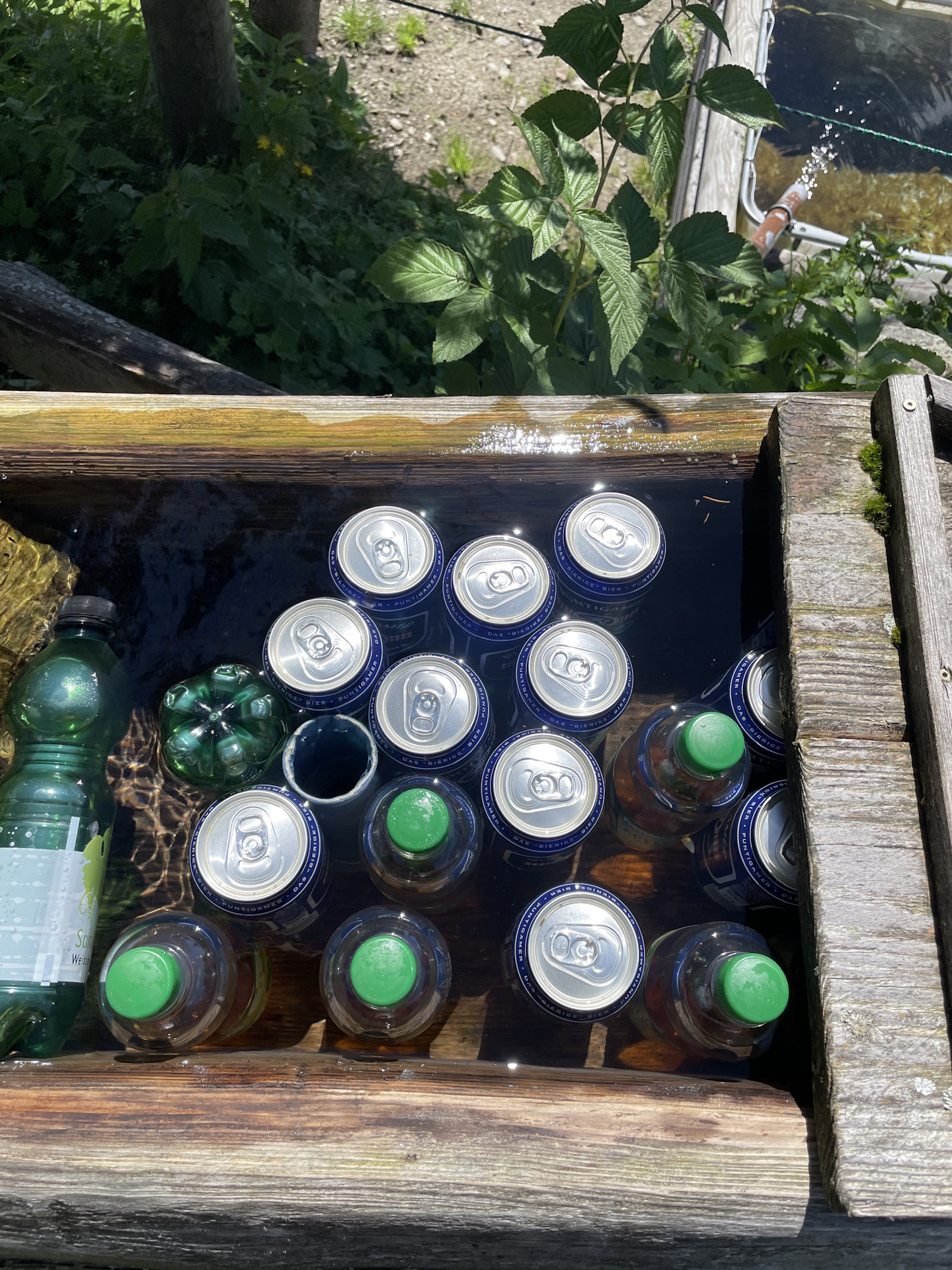
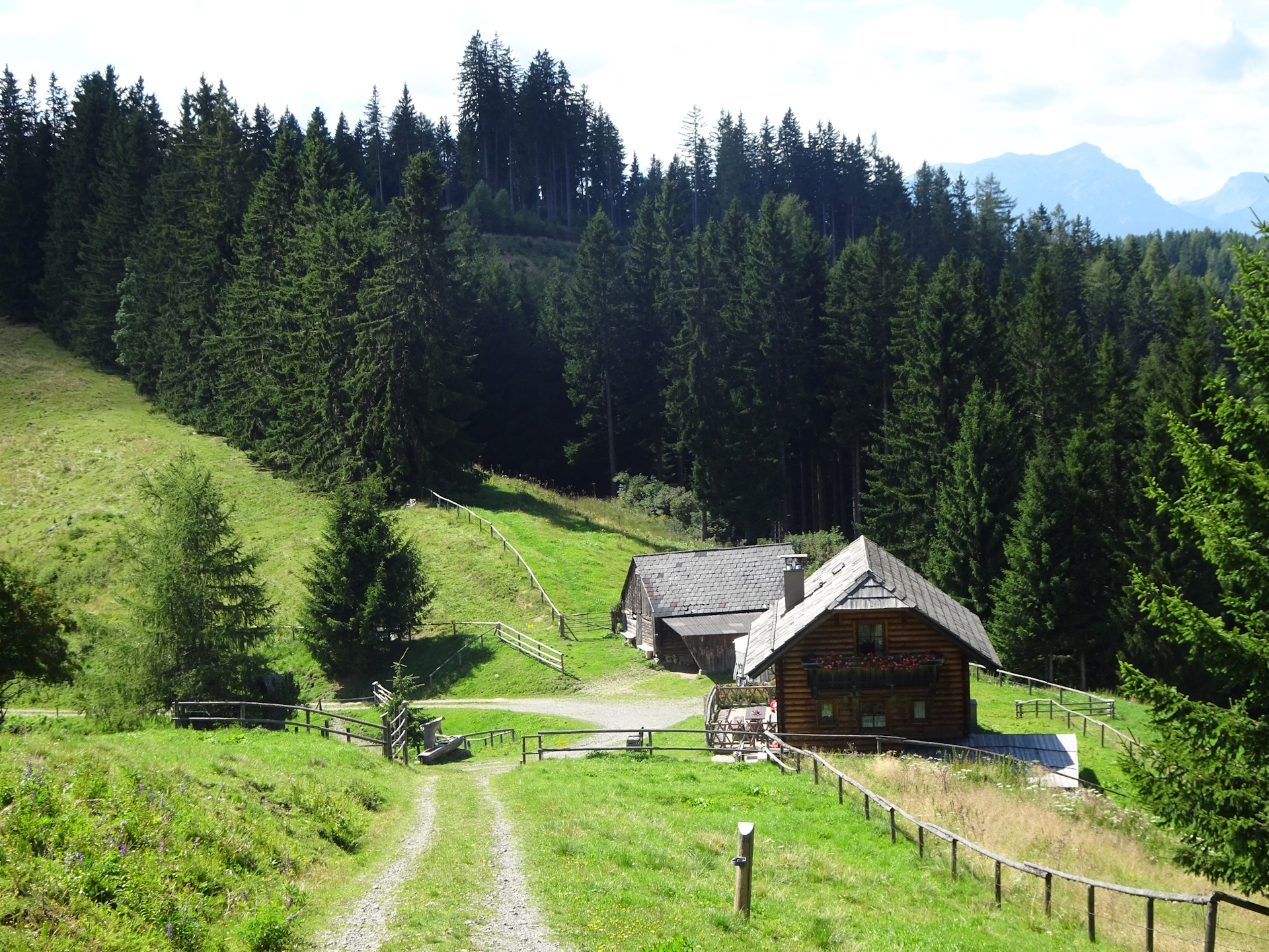
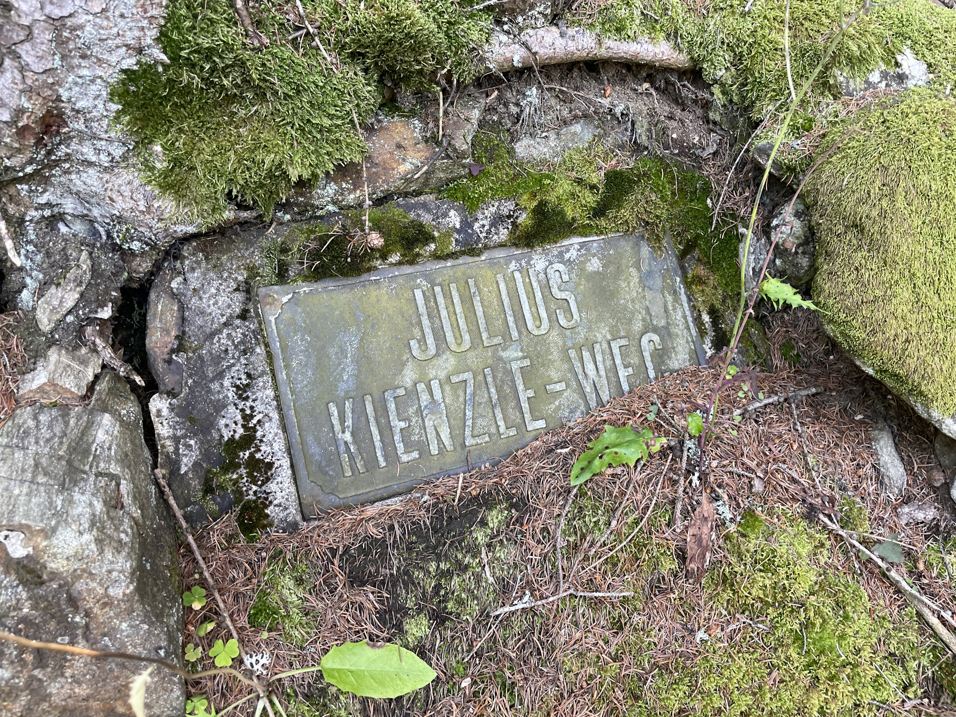
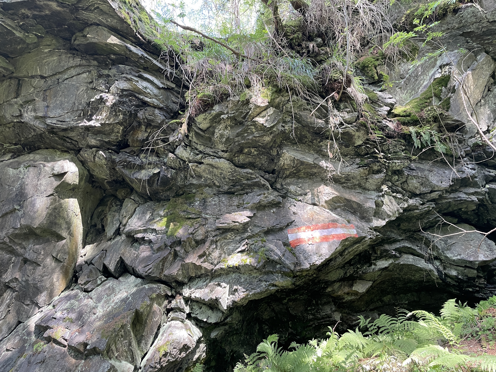
I then continued on the official trail, mainly trough forests being happy to have some shadow on a really hot day. I decided to skip the break at Pampichler Warte and do it later at Schmollhube as the hike now became steep and I wanted to use my momentum . Once I reached Schmollhube however, I noticed my mistake as the hut was closed and although there were signs of a self-service possibility, I was not able to find anywhere a drink to buy . Thus, I continued the tour eastwards towards Mugel and found myself with a happy surprise at the Gstattmoaralm. Not only there was an empty bench with an amazing view, but there was also beer cooled in the water well. After having two very refreshing cooled beers, I continued my final ascent towards Mugel via the Julius Kienzle Weg. The trail is in the beginning fairly steep but gets easier the closer you come to the summit of Mugel.
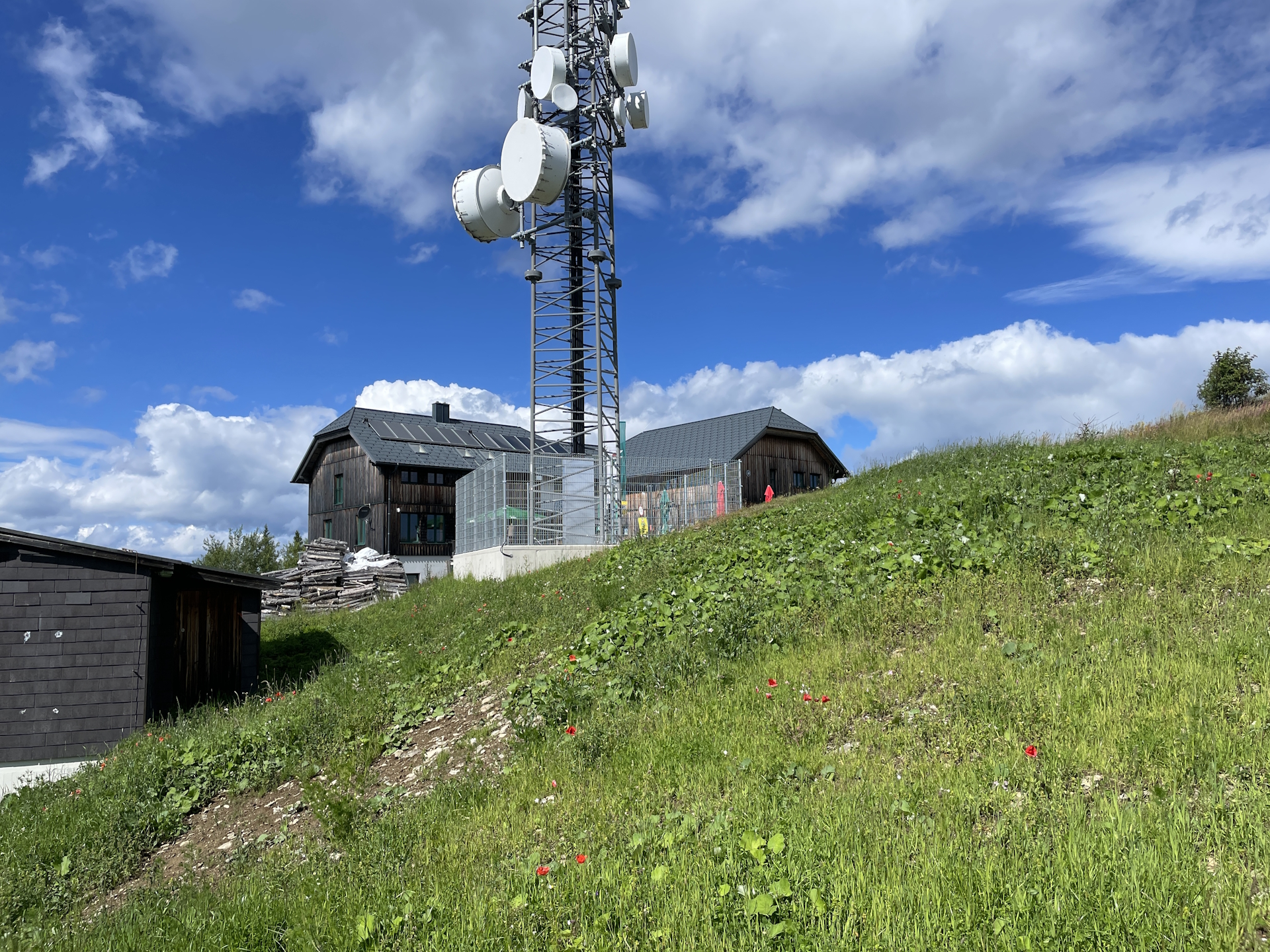
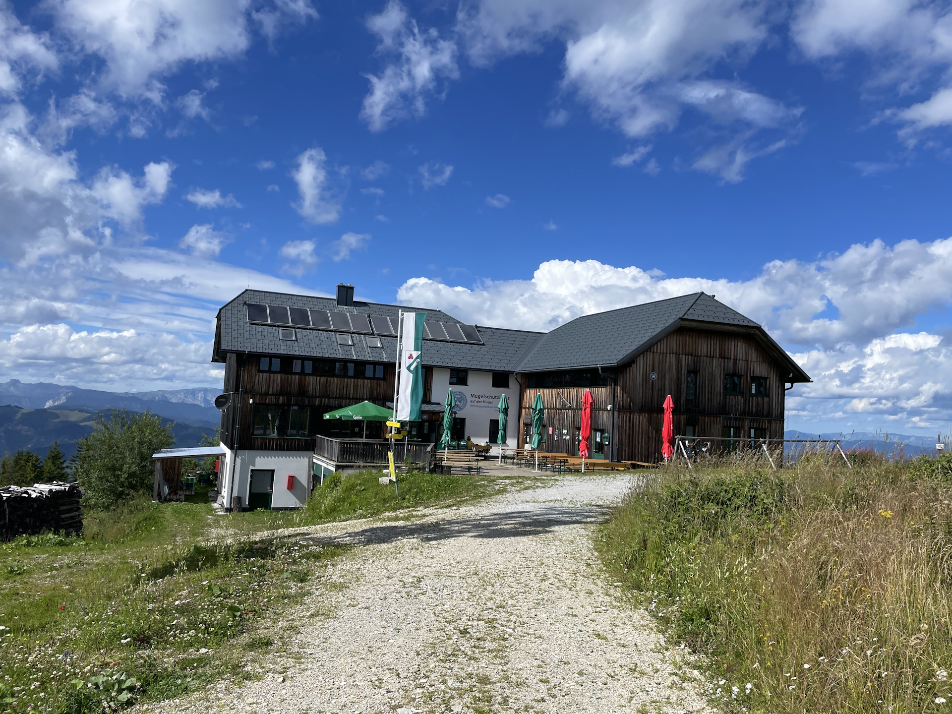
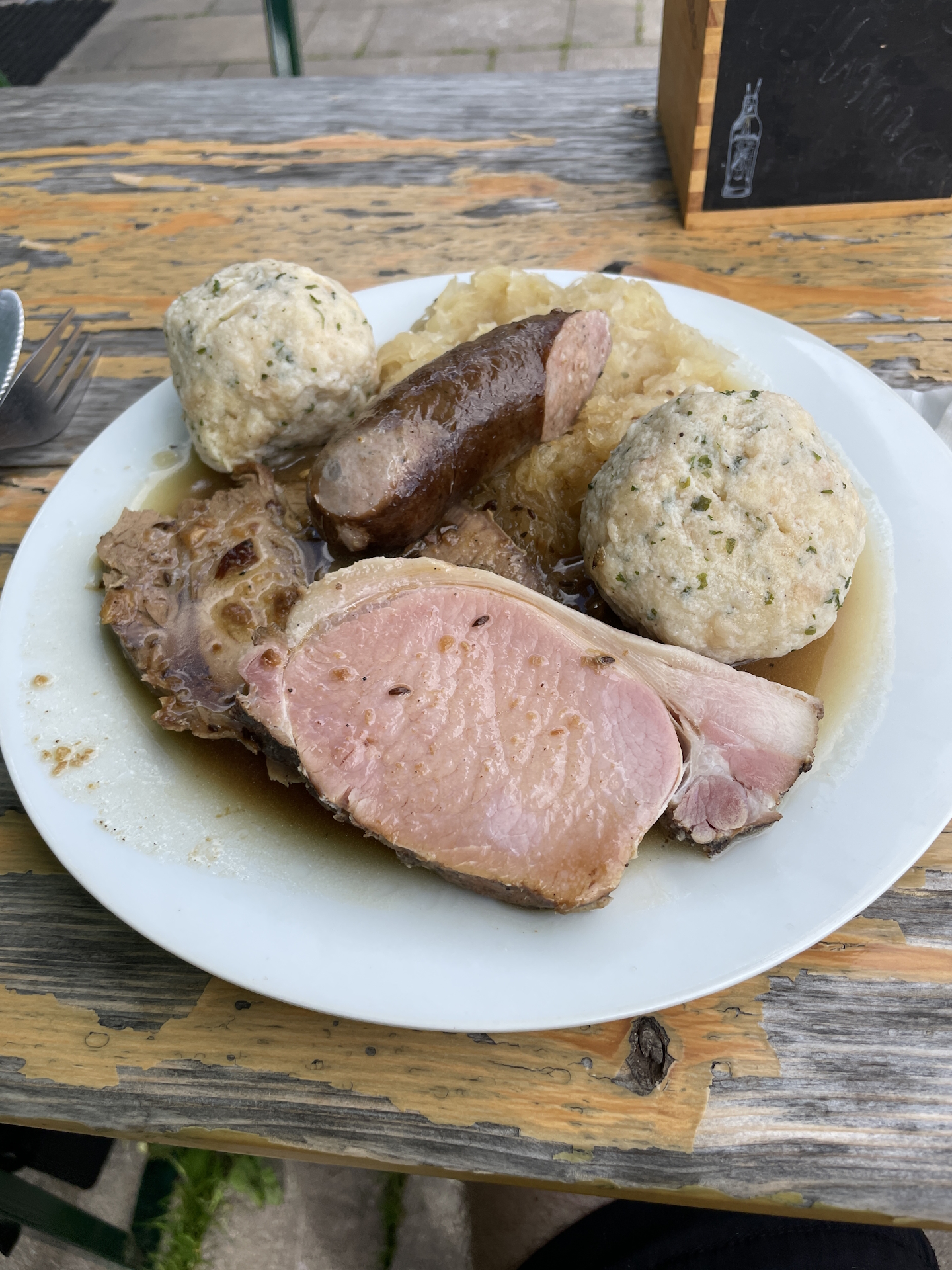
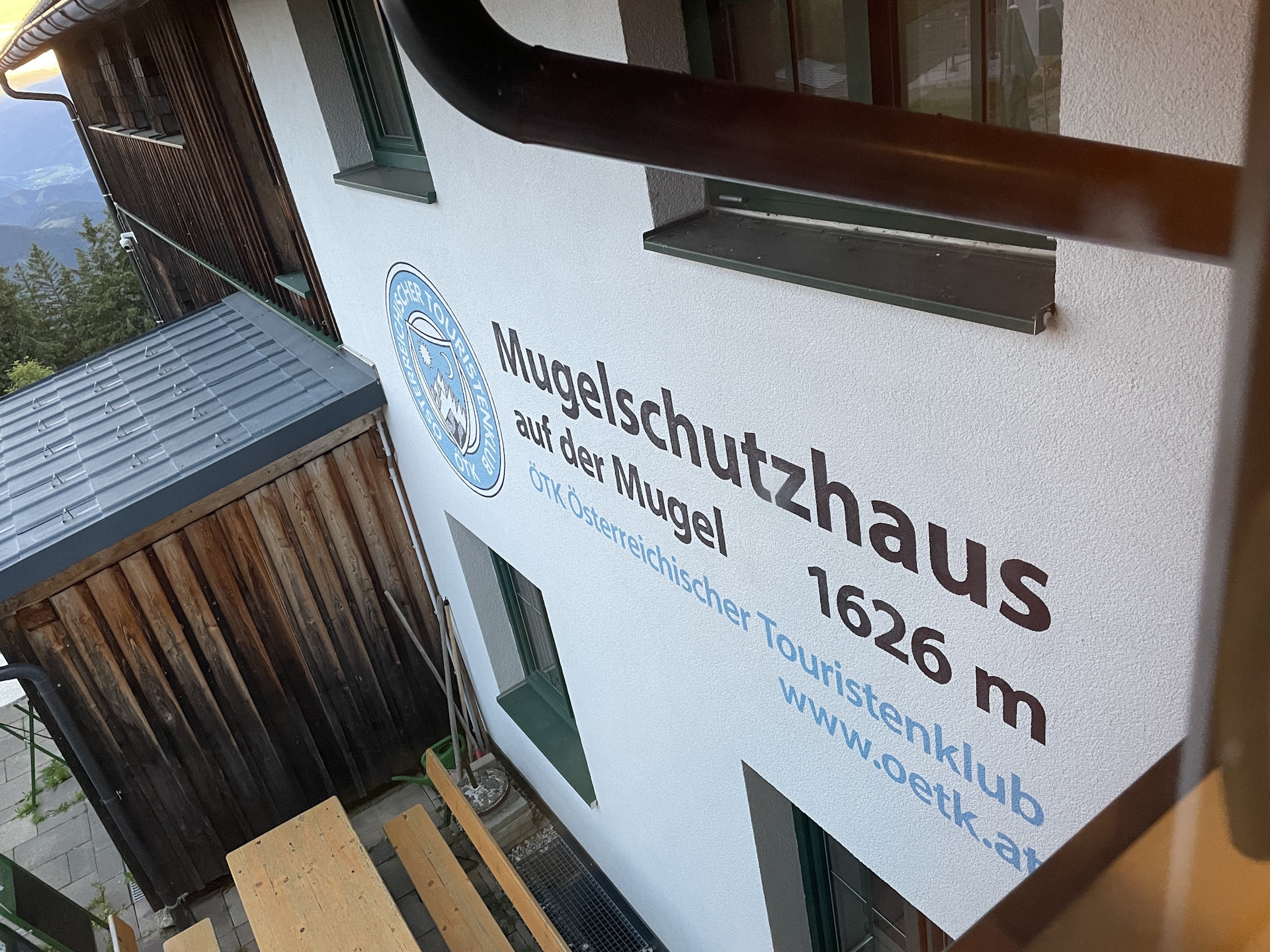
I finally arrived at the Mugel and the Mugelschutzhütte (Checkpoint) in good time. After having some refreshing beers and getting my stamp , I also got excellent food! Turned out that the current tenant is a professional cook – and that you could taste!
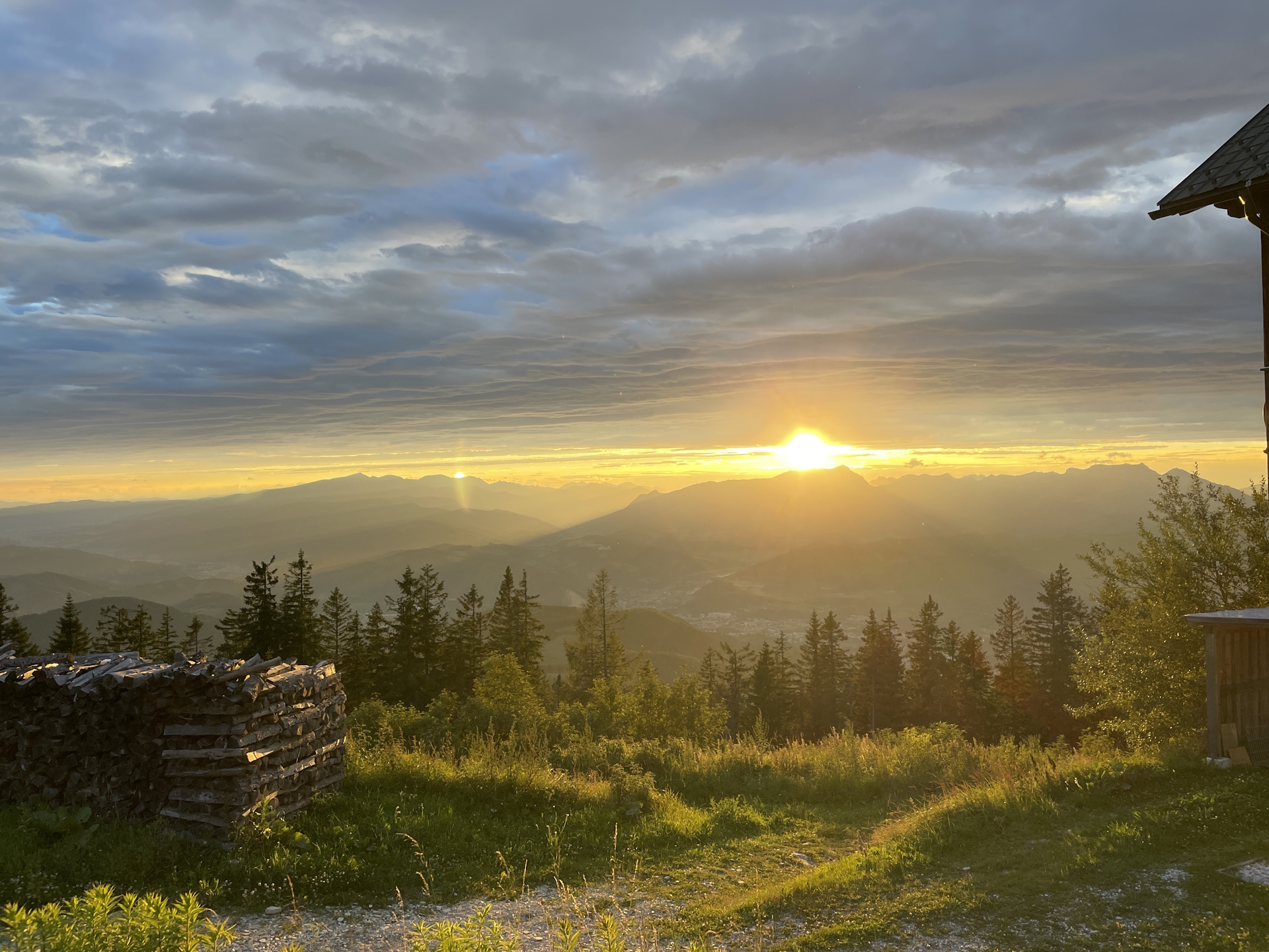
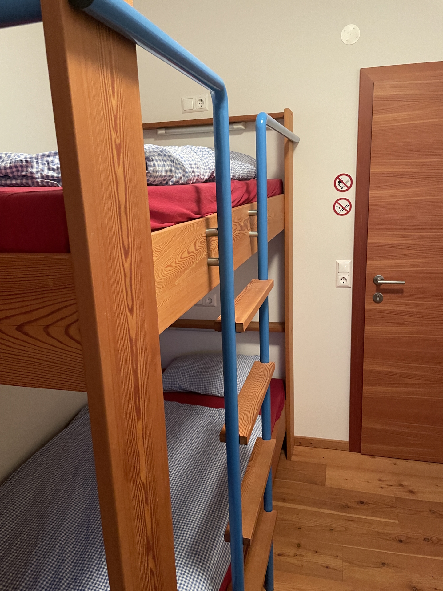
After my dinner, I continued having a super nice conversation with the tenants before we enjoyed a super nice sunset and finally went to bed. Turned out I was the only guest this night, got very special and friendly treatment and slept super well in the comfortable beds at the Mugelschutzhütte.
Summary:
Overall, an easy but very scenic stage. Although it was a super hot day, the stage was doable since it was most of the time following trails through a forest with a lot of shadow. The best however was the overnight stay at the Mugelschutzhaus, the excellent food served and the super nice tenants running the hut! Thanks to Roman & Michaela who made my stay there an unforgettable experience!
| 00:00 | Start at the train station Leoben Hauptbahnhof. Cross the Mur river via the Südbahnbrücke in front of the train station and follow the street southeastwards into the city center. |
| 00:15 | Acquire your stamp at the tourist information center and have lunch () at one of the restaurants around (e.g. Arkardenhof). |
| 01:35 | At the end of the main square, turn left and follow the street till its end. Then turn right and now follow the official 05 trail southwards. |
| 01:40 | Cross the big street (Kärtnerstraße) and continue following the trail straight ahead on the other side of the street. Keep straight and use the stairs and then follow the street up towards the castle. |
| 01:45 | At the Maßenburg castle, walk through the main gate and then through the yard to the view point. Enjoy the amazing view towards the city and the surrounding mountain scenery. Head back through the main gate and continue following the marked trail towards Schmollhube / Mugel (see signposts). |
| 01:55 | Turn right and continue following the marked trail towards Schmollhube. |
| 02:00 | Cross the forest road and turn right, following the trail up to Schmollhube. |
| 02:05 | Turn left and continue following the red-white-red marked trail southeastwards. |
| 02:10 | A few meters before the Gasthaus Pampichler Warte, turn left and follow the marked trail eastwards. |
| 02:15 | Keep straight and follow the trail on the right hand-side! |
| 02:50 | At the crossing, leave the gravel road by turning right following the red-white-red marked trail southwards. |
| 03:25 | Cross the gravel road and keep following the red-white-red marked trail eastwards. |
| 03:40 | Turn right and follow the trail towards the already visible Schmollhube hut. If open, consider a break and get some refreshments (). |
| 03:45 | Continue following the gravel road northeastwards and then turn right, following the gravel road eastwards through the forest. |
| 03:55 | At the crossing, leave the forest road by turning slightly right and continue following the red-white-red marked trail eastwards. |
| 04:10 | Well-deserved break () at the Gstattmoaralm. Cold beverages are found in the water well. |
| 04:35 | Continue following the marked trail eastwards. Follow the gravel road for only a few meters, enjoy the exciting view and make sure turning right and using the marked trail through the meadow into the forest. The trail will cross several times forest roads. Ensure staying on the trail by following the markings. |
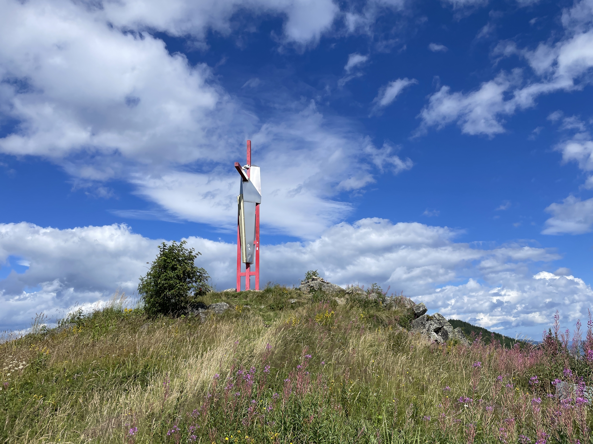
| 05:25 | At the crossing, turn sharp right and then left again and follow the trail leading directly up to the summit of Mugel. |
| 05:35 | Arrival at the summit of Mugel and the Mugelschutzhaus hut directly next to it. Check-in for the night, enjoy a nice dinner () and don’t forget to acquire a stamp ! End of the tour! |
| Area: | Erzberg-Leoben, Styria, Austria | |
| Distance: | 11km | |
| Ascent: | 1167m (3h 00min) | |
| Descent: | 89m (0h 20min) | |
| Highest Pt: | 1630m | |
| Lowest Pt: | 536m | |
| Duration: | 4h 00min (without breaks) 5h 35min (with breaks) |
|
| Stop/Rest: | Arkadenhof Leoben (542m) Gasthaus Pampichler Warte (694m) Schmollhube (1145m) Mugelschutzhaus (1630m) |
|
| Equipment: | Backpack with standard hiking equipment Comfortable hiking shoes Snacks and plenty of water Sun & Weather protection Camera Overnight equipment for the hut: – light sleeping bag for huts – cash – shoes for the hut – toiletries |
| Download GPX | ||
| O | Tour at outdooractive.com |
At a glance
| Level | easy-medium |
| Technique | |
| Shape / Fitness | |
| Experience | |
| Scenery | |
| Best time in the year | |
|
Jan
Feb
Mar
Apr
May
Jun
Jul
Aug
Sep
Oct
Nov
Dec
|
|
Leave a Reply